Loading...
Changeset: 170372
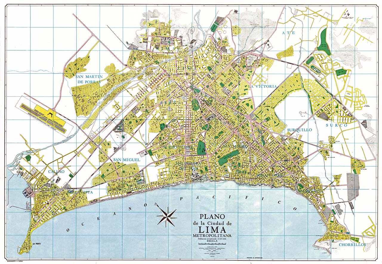
Calles añadidas según plano de Lima de 1965
Closed by El Surquillano
Tags
| changesets_count | 66 |
|---|---|
| created_by | iD 2.29.3 |
| host | https://www.openhistoricalmap.org/edit |
| ideditor:walkthrough_completed | yes |
| ideditor:walkthrough_progress | welcome;navigation;point;area;line;building;startEditing |
| ideditor:walkthrough_started | yes |
| imagery_used | OpenStreetMap (Standard) |
| locale | es |
| source:date | 1965 |
| source:name | Plano de la Ciudad de Lima Metropolitana |
| source:url | https://lima2000.com/wp-content/uploads/2016/12/1965Plano187.jpg |
| warnings:crossing_ways:highway-highway | 5 |
| warnings:disconnected_way:highway | 3 |
| warnings:impossible_oneway:highway | 14 |
Discussion
Ways (101-120 of 138)
- Avenida Universitaria [1965 – ] (200983449), v1
- Avenida Universitaria [1965 – ] (200983450), v1
- [1965 – ] (200983451), v1
- [1965 – ] (200983452), v1
- [1965 – ] (200983453), v1
- [1965 – ] (200983454), v1
- [1965 – ] (200983455), v1
- [1965 – ] (200983456), v1
- [1965 – ] (200983457), v1
- [1965 – ] (200983458), v1
- [1965 – ] (200983459), v1
- [1965 – ] (200983460), v1
- [1965 – ] (200983461), v1
- [1965 – ] (200983462), v1
- [1965 – ] (200983463), v1
- [1965 – ] (200983464), v1
- [1965 – ] (200983465), v1
- [1965 – ] (200983466), v1
- [1965 – ] (200983467), v1
- [1965 – ] (200983468), v1
Nodes (1-20 of 941)
Welcome to OpenHistoricalMap!
OpenHistoricalMap is an interactive map of the world throughout history, created by people like you and dedicated to the public domain.
OpenHistoricalMap is a charter project of OpenStreetMap U.S., a 501(c)(3) nonprofit organization affiliated with the OpenStreetMap Foundation. Technical development is supported by GreenInfo Network and Development Seed.
| https://www.openhistoricalmap.org/copyright | https://www.openhistoricalmap.org |
| OpenHistoricalMap is dedicated to the public domain except where otherwise noted. | |