Loading...
Changeset: 179757
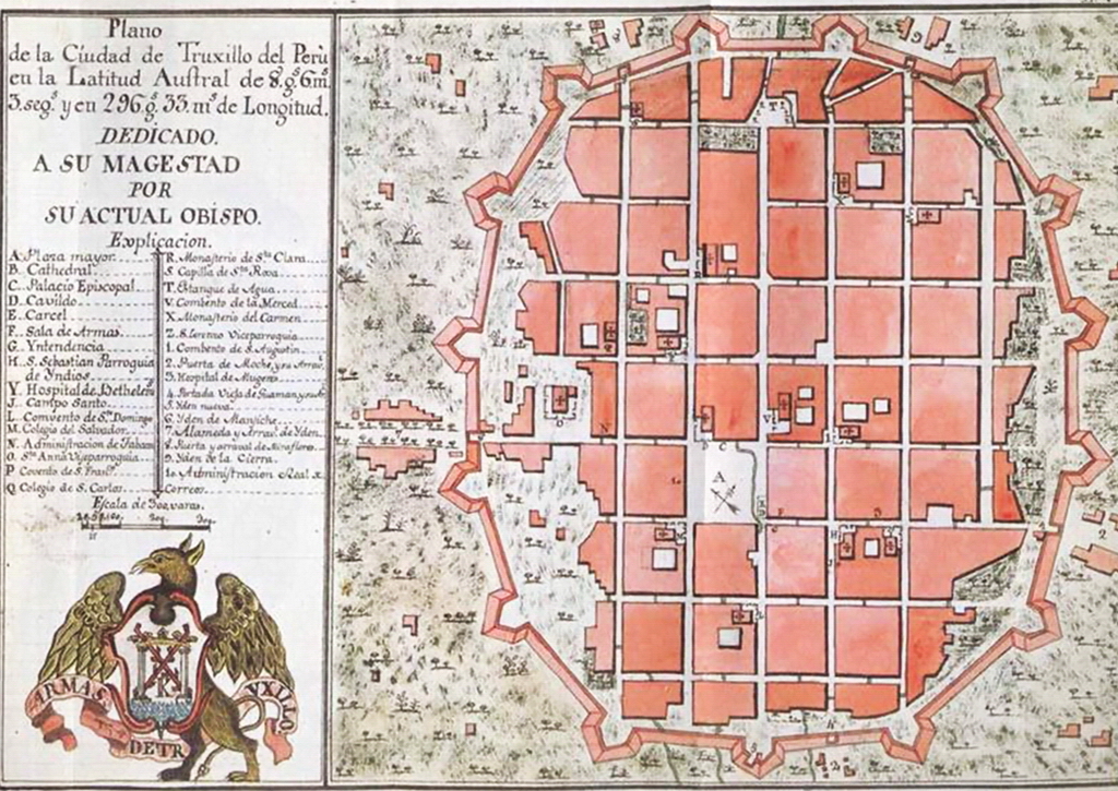
Calles añadidas según plano de Trujillo de 1786
Closed by El Surquillano
Tags
| changesets_count | 72 |
|---|---|
| created_by | iD 2.29.3 |
| host | https://www.openhistoricalmap.org/edit |
| imagery_used | Esri World Imagery;OpenStreetMap (Standard) |
| locale | es |
| source:url | https://upload.wikimedia.org/wikipedia/commons/4/4e/Plano_Trujillo_1786.jpg |
| warnings:disconnected_way:highway | 1 |
Discussion
Ways (17)
- Farfán - Valle de Moche [1438 – 1500] (198601437), v2
- Plaza Mayor de Trujillo [1535 – ] (201135064), v1
- [1786 – ] (201135065), v1
- [1786 – ] (201135066), v1
- [1786 – ] (201135067), v1
- [1786 – ] (201135068), v1
- [1786 – ] (201135069), v1
- [1786 – ] (201135070), v1
- [1786 – ] (201135071), v1
- [1786 – ] (201135072), v1
- [1786 – ] (201135073), v1
- [1786 – ] (201135074), v1
- [1786 – ] (201135075), v1
- [1786 – ] (201135076), v1
- [1786 – ] (201135077), v1
- [1786 – ] (201135078), v1
- [1786 – ] (201135079), v1
Nodes (1-20 of 80)
Welcome to OpenHistoricalMap!
OpenHistoricalMap is an interactive map of the world throughout history, created by people like you and dedicated to the public domain.
OpenHistoricalMap is a charter project of OpenStreetMap U.S., a 501(c)(3) nonprofit organization affiliated with the OpenStreetMap Foundation. Technical development is supported by GreenInfo Network and Development Seed.
| https://www.openhistoricalmap.org/copyright | https://www.openhistoricalmap.org |
| OpenHistoricalMap is dedicated to the public domain except where otherwise noted. | |