Loading...
Changeset: 27799
Detaillierung Grenzverlauf
Closed by MHE
Tags
| created_by | JOSM/1.5 (18193 de) |
|---|---|
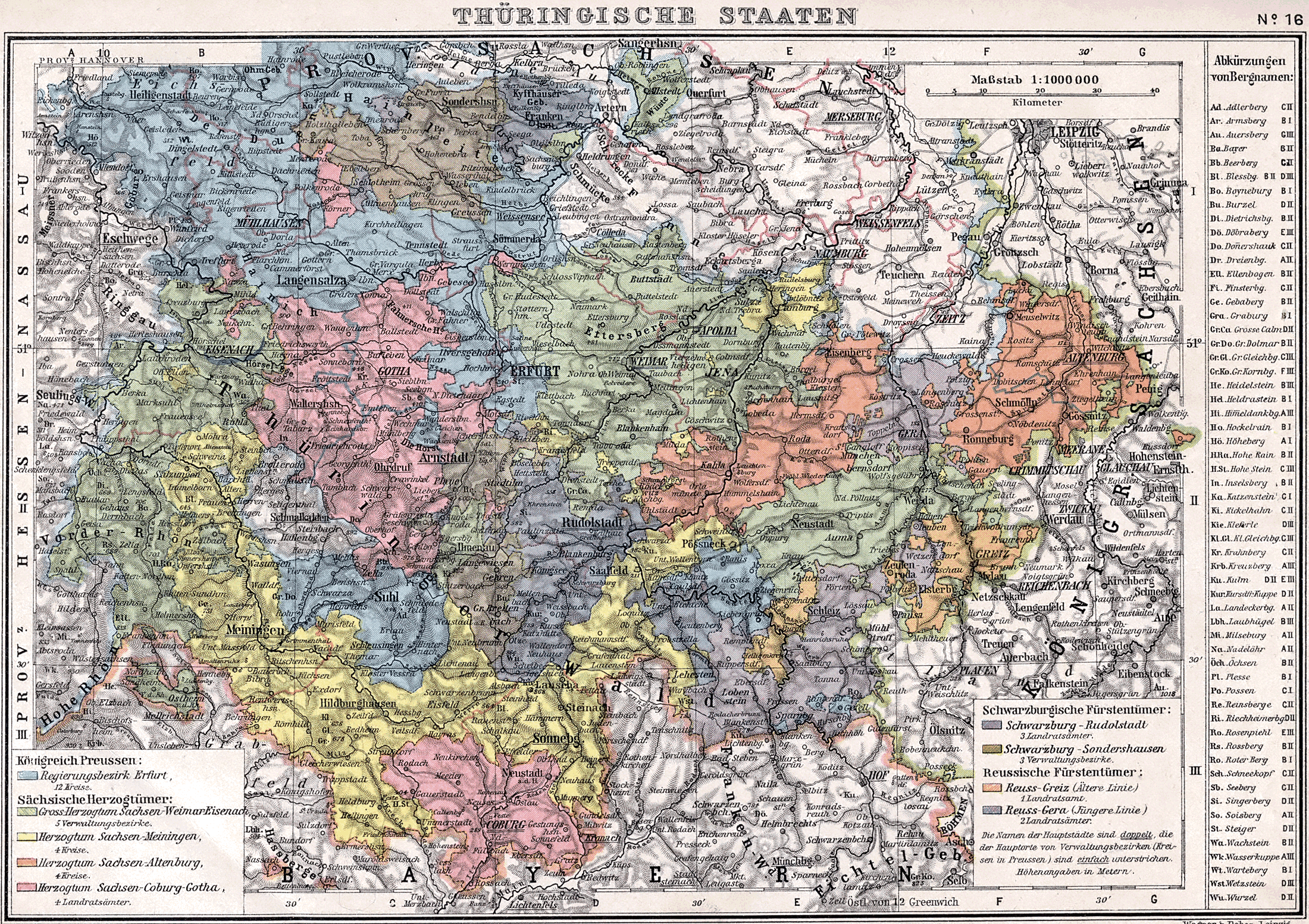
| source | https://upload.wikimedia.org/wikipedia/commons/b/b4/Thueringsche_Staaten_1905.png |
Discussion
Ways (7)
Relations (1-20 of 21)
- 1
- 2
- Hessen-Nassau (1868-1929) [1868 – 1929] (2690442), v16
- Kurhessen (1815-1866) [1815 – 1866] (2690444), v15
- Kurhessen [1944 – 1945] (2690497), v7
- Hessen-Nassau (1929-1937) [1929 – 1937] (2690499), v14
- Hessen-Nassau (1937-1944) [1937 – 1944] (2690500), v14
- Hessen [1946 – ] (2690505), v7
- Groß-Hessen [1945 – 1946] (2690506), v6
- Deutschland (1949-1990) [1949 – 1990] (2692237), v41
- Deutsche Demokratische Republik (1951-1990) [1951 – 1990] (2692241), v38
- Thüringen (1990-1991) [1990 – 1991] (2692302), v41
- Bezirk Erfurt (1952-1990) [1952 – 1990] (2692303), v44
- Sachsen-Weimar-Eisenach (1809-1920) [1809 – 1920] (2692487), v81
- Thüringen (1992-) [1992 – ] (2693416), v46
- Eisenach [1922 – 1946] (2693516), v17
- Dermbach (2693517), v15
- Eisenach [1850 – 1922] (2693518), v12
- Eisenacher Kreis [1874 – 1918] (2693519), v22
- Königreich Preußen (1867-1876) [1867 – 1876] (2693579), v104
- Königreich Preußen (1876-1918) [1876 – 1918] (2693613), v101
- Königreich Preußen (1866-1867) [1866 – 1867] (2694592), v71
Nodes (81-100 of 191)
Welcome to OpenHistoricalMap!
OpenHistoricalMap is an interactive map of the world throughout history, created by people like you and dedicated to the public domain.
OpenHistoricalMap is a charter project of OpenStreetMap U.S., a 501(c)(3) nonprofit organization affiliated with the OpenStreetMap Foundation. Technical development is supported by GreenInfo Network and Development Seed.
| https://www.openhistoricalmap.org/copyright | https://www.openhistoricalmap.org |
| OpenHistoricalMap is dedicated to the public domain except where otherwise noted. | |