Loading...
Changeset: 35026
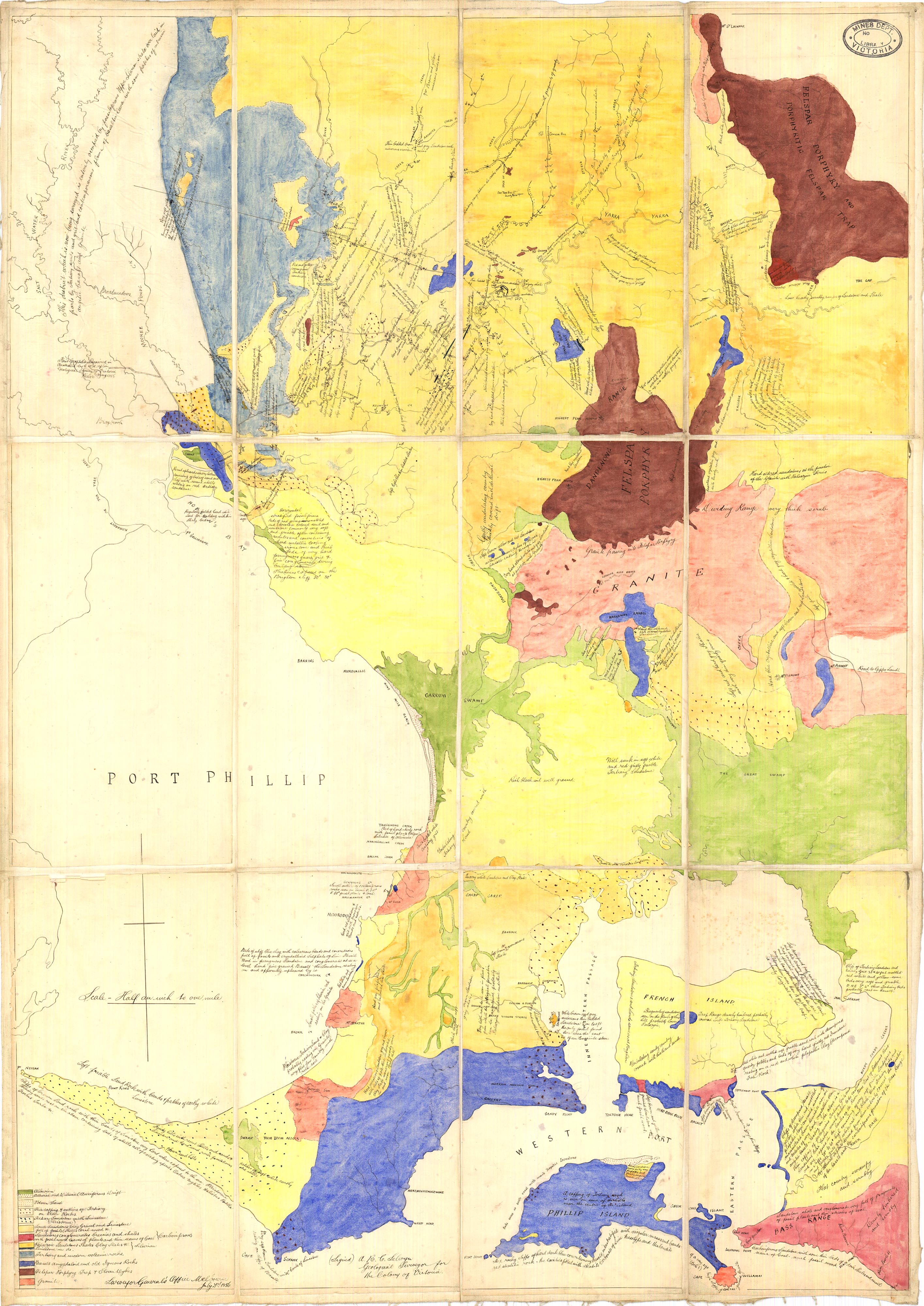
Updates to base land type based no multiple sources in the area. Needs refining of the dates
Closed by ChristoEvans
Tags
| created_by | JOSM/1.5 (18360 en_AU) |
|---|---|
| source | https://earthresources.vic.gov.au/__data/assets/image/0005/462416/Yarra-River-Basin-large.jpg |
Discussion
Ways (20)
- Spencer Street [1837 – ] (198778102), v3
- 198782566, v2
- 198782570, v2
- 198783219, v2
- 198789453, v2
- 198789479, v2
- 198789682, v1
- 198789683, v1
- 198789684, v1
- 198789685, v1
- 198789686, v1
- 198789687, v1
- 198789688, v1
- 198789689, v1
- 198789690, v1
- 198789691, v1
- 198789692, v1
- [1836 – 1866] (198789693), v1
- 198789694, v1
- 198789695, v1
Relations (11)
Nodes (101-120 of 212)
Welcome to OpenHistoricalMap!
OpenHistoricalMap is an interactive map of the world throughout history, created by people like you and dedicated to the public domain.
OpenHistoricalMap is a charter project of OpenStreetMap U.S., a 501(c)(3) nonprofit organization affiliated with the OpenStreetMap Foundation. Technical development is supported by GreenInfo Network and Development Seed.
| https://www.openhistoricalmap.org/copyright | https://www.openhistoricalmap.org |
| OpenHistoricalMap is dedicated to the public domain except where otherwise noted. | |