Loading...
Changeset: 8416
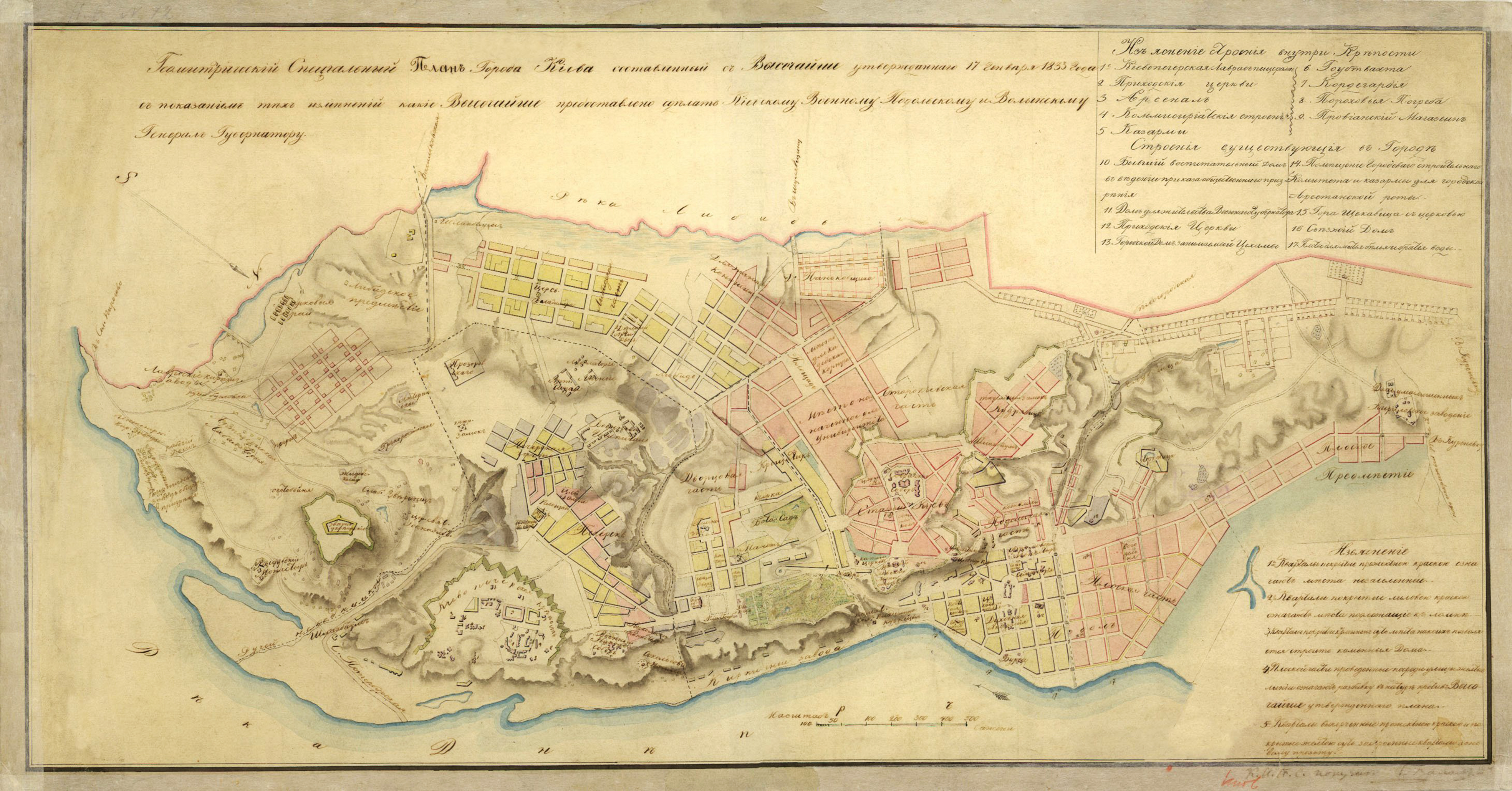
Changes of residendial areas before the 1820's in Kiev
Closed by Charles Alexis Gérard
Tags
| changesets_count | 79 |
|---|---|
| created_by | iD 2.13.1 |
| host | https://www.openhistoricalmap.org/edit |
| ideditor:walkthrough_progress | welcome;startEditing |
| ideditor:walkthrough_started | yes |
| imagery_used | Custom (https://mapwarper.net/maps/tile/48173/{z}/{x}/{y}.png) |
| locale | fr |
| source | Map of 1833 https://upload.wikimedia.org/wikipedia/commons/4/47/1833_%D0%9F%D0%BB%D0%B0%D0%BD_%D0%9A%D0%B8%D1%94%D0%B2%D0%B0.jpg;https://commons.wikimedia.org/wiki/File:Kyiv_plan_1787.png |
Discussion
Ways (3)
Welcome to OpenHistoricalMap!
OpenHistoricalMap is an interactive map of the world throughout history, created by people like you and dedicated to the public domain.
OpenHistoricalMap is a charter project of OpenStreetMap U.S., a 501(c)(3) nonprofit organization affiliated with the OpenStreetMap Foundation. Technical development is supported by GreenInfo Network and Development Seed.
| https://www.openhistoricalmap.org/copyright | https://www.openhistoricalmap.org |
| OpenHistoricalMap is dedicated to the public domain except where otherwise noted. | |