Loading...
Changeset: 8420
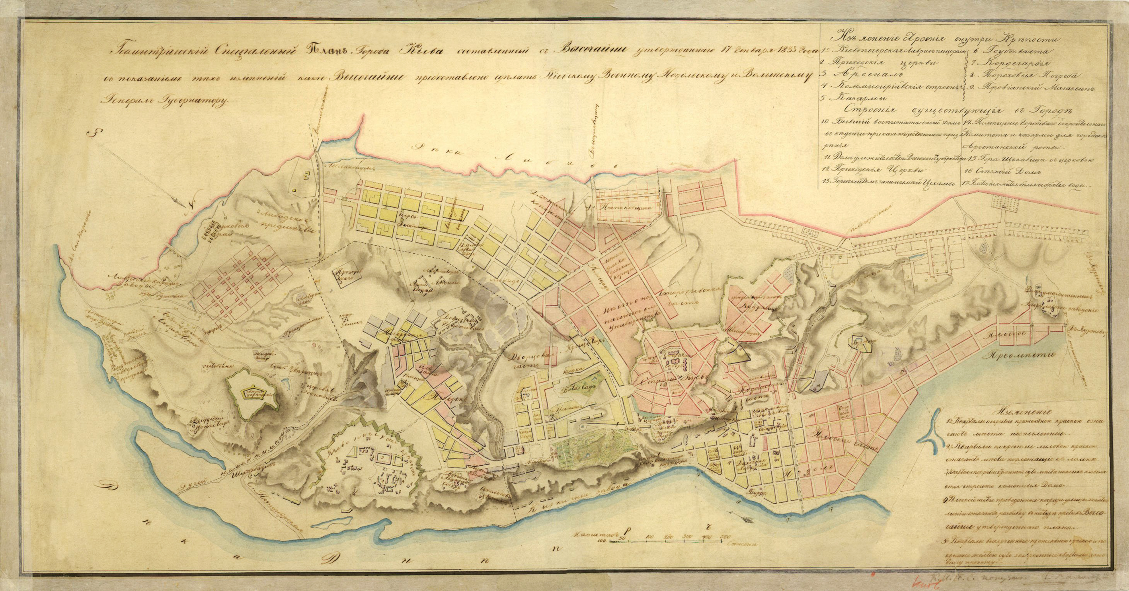
Changes of roads before the 1820's in Kiev
Closed by Charles Alexis Gérard
Tags
| changesets_count | 81 |
|---|---|
| created_by | iD 2.13.1 |
| host | https://www.openhistoricalmap.org/edit |
| ideditor:walkthrough_progress | welcome;startEditing |
| ideditor:walkthrough_started | yes |
| imagery_used | Custom (https://mapwarper.net/maps/tile/48173/{z}/{x}/{y}.png) |
| locale | fr |
| source | Map of 1833 https://upload.wikimedia.org/wikipedia/commons/4/47/1833_%D0%9F%D0%BB%D0%B0%D0%BD_%D0%9A%D0%B8%D1%94%D0%B2%D0%B0.jpg |
Discussion
Ways (1)
Nodes (9)
Welcome to OpenHistoricalMap!
OpenHistoricalMap is an interactive map of the world throughout history, created by people like you and dedicated to the public domain.
OpenHistoricalMap is a charter project of OpenStreetMap U.S., a 501(c)(3) nonprofit organization affiliated with the OpenStreetMap Foundation. Technical development is supported by GreenInfo Network and Development Seed.
| https://www.openhistoricalmap.org/copyright | https://www.openhistoricalmap.org |
| OpenHistoricalMap is dedicated to the public domain except where otherwise noted. | |