Loading...
Node: 2130331429
Version #6
given, removing type=source and type=geometry from linestrings and points
- Edited by flha127
- Changeset #171241
- Location: 51.2205970, 3.2242300
Tags
| ! | source, please do not delete |
|---|---|
| source | photograph |
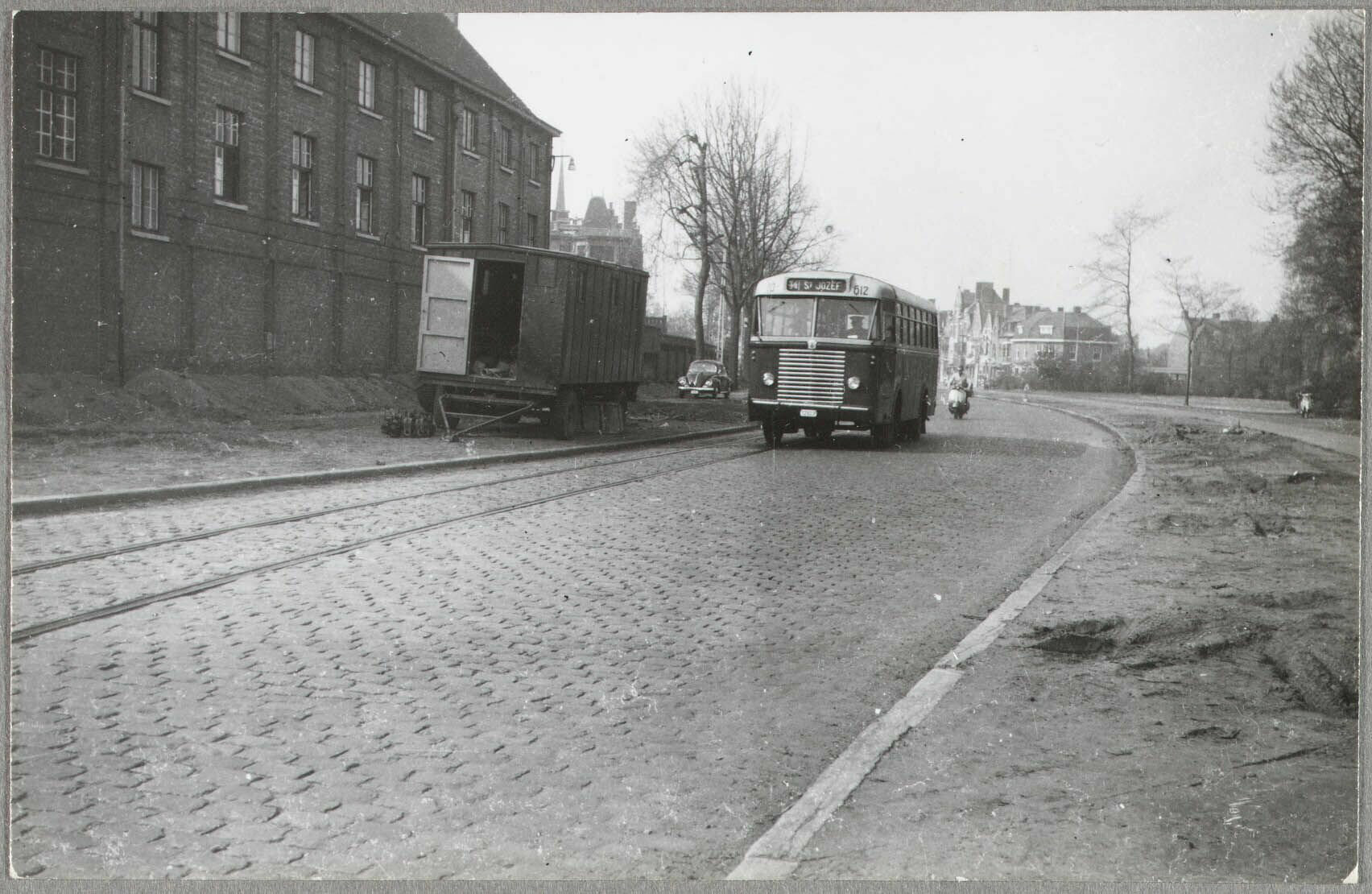
| source:description | Chevrolet GT30/Jonckheere 827 sur la ligne 3/4 Brugge Station - Sint-Jozef (devenue 8 puis 14, supprimée le 30/06/2023) circulant vers Sint-Jozef sur le Komvest en 1957, les rails sont ceux de la ligne 10 supprimée en 56. |
| source:link | https://www.facebook.com/photo/?fbid=120220044477052 |
| source:name | Archives de la ville de Bruges |
| source:photograph_link | https://i.goopics.net/8tvfuv.jpg |
Welcome to OpenHistoricalMap!
OpenHistoricalMap is an interactive map of the world throughout history, created by people like you and dedicated to the public domain.
OpenHistoricalMap is a charter project of OpenStreetMap U.S., a 501(c)(3) nonprofit organization affiliated with the OpenStreetMap Foundation. Technical development is supported by GreenInfo Network and Development Seed.
| https://www.openhistoricalmap.org/copyright | https://www.openhistoricalmap.org |
| OpenHistoricalMap is dedicated to the public domain except where otherwise noted. | |