Loading...
Relation: Ahmadnagar Sultanate [1490 – 1636] (2847885)
Version #2
moving India-related relation boundaries offshore in prep for a different import
Tags
| admin_level | 2 |
|---|---|
| boundary | administrative |
| end_date | 1636 |
| end_event | Aurangzeb annexes Ahmadnagar Sultanate into Mughal Empire |
| name | Ahmadnagar Sultanate |
| name:fa | نظامشاهیان احمدنگر |
| name:hi | अहमदनगर सल्तनत |
| name:mr | निजामशाही |
| name:ta | அகமதுநகர் சுல்தானகம் |
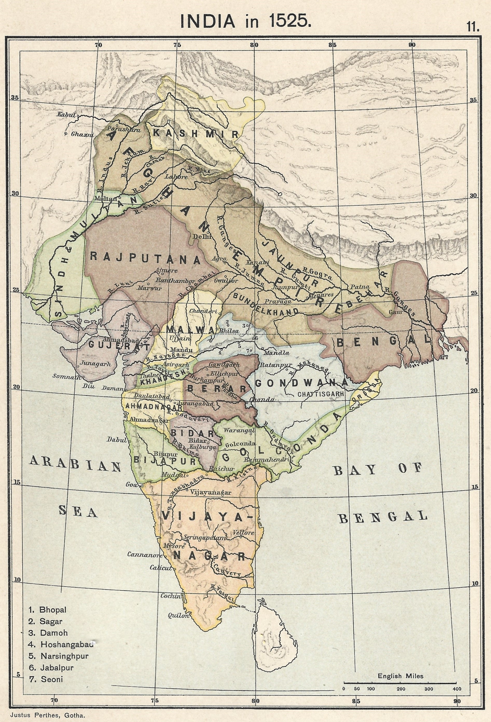
| source | https://upload.wikimedia.org/wikipedia/commons/0/06/Joppen_map-India_in_1525_published_1907_by_Longmans.jpg |
| source:name | India in 1525, Joppe |
| source:tiles | https://mapwarper.net/maps/tile/88795/{z}/{x}/{y}.png |
| start_date | 1490-05-28 |
| start_event | Malik Ahmed, Bahmani gover of Junnar defeats Bahmani army, declares independence, and establishes Ahmednagar Sultanate |
| type | boundary |
| wikidata | Q400998 |
| wikipedia | en:Ahmadnagar Sultanate |
Members
Welcome to OpenHistoricalMap!
OpenHistoricalMap is an interactive map of the world throughout history, created by people like you and dedicated to the public domain.
OpenHistoricalMap is a charter project of OpenStreetMap U.S., a 501(c)(3) nonprofit organization affiliated with the OpenStreetMap Foundation. Technical development is supported by GreenInfo Network and Development Seed.
| https://www.openhistoricalmap.org/copyright | https://www.openhistoricalmap.org |
| OpenHistoricalMap is dedicated to the public domain except where otherwise noted. | |