Loading...
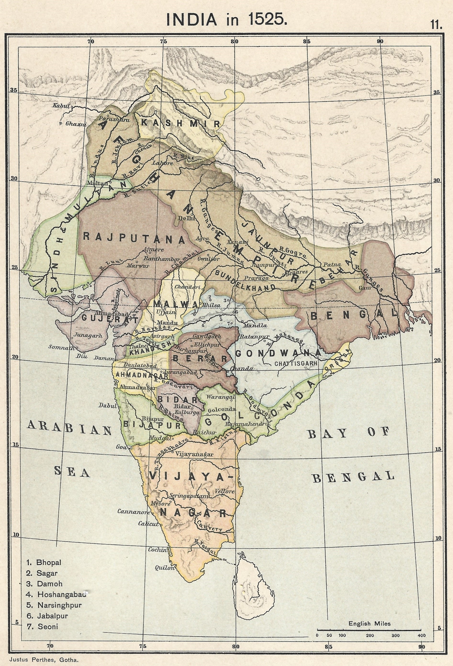
Relation: Rajputana [1128 – 1525] (2847898)
Version #3
improve Indian states
- Edited by CharliePlett
- Changeset #156159
Tags
| admin_level | 2 |
|---|---|
| alt_name | Rajpootana |
| boundary | administrative |
| end_date | 1525 |
| end_date:source | time depicted on source map |
| fixme | additional boundary evolution; end_date of this version |
| name | Rajputana |
| name:bn | রাজপুতানা |
| name:hi | राजपूताना |
| name:ta | இராஜபுதனம் |
| place | federation |
| source | https://upload.wikimedia.org/wikipedia/commons/0/06/Joppen_map-India_in_1525_published_1907_by_Longmans.jpg |
| source:name | India in 1525, Joppe |
| source:tiles | https://mapwarper.net/maps/tile/88795/{z}/{x}/{y}.png |
| start_date | 1128 |
| type | boundary |
| wikidata | Q3929733 |
| wikipedia | en:Rajputana |
Members
14 members
- Way 200792643 as outer
- Way 200805001 as outer
- Way 200805003 as outer
- Way 200813078 as outer
- Way 200813079 as outer
Way 200792644 as outer- Way 200805005 as outer
- Way 200805006 as outer
- Way 200792646 as outer
- Way 200792645 as outer
- Way 200805528 as outer
- Way 200805529 as outer
- Way 200813064 as outer
- Way 200804997 as outer
Welcome to OpenHistoricalMap!
OpenHistoricalMap is an interactive map of the world throughout history, created by people like you and dedicated to the public domain.
OpenHistoricalMap is a charter project of OpenStreetMap U.S., a 501(c)(3) nonprofit organization affiliated with the OpenStreetMap Foundation. Technical development is supported by GreenInfo Network and Development Seed.
| https://www.openhistoricalmap.org/copyright | https://www.openhistoricalmap.org |
| OpenHistoricalMap is dedicated to the public domain except where otherwise noted. | |