Loading...
Relation: Rajputana [1128 – 1525] (2847898)
Version #5
mapping Sind in relation to the Umayyads and Abbassid
- Edited by CharliePlett
- Changeset #179485
Tags
| admin_level | 2 |
|---|---|
| alt_name | Rajpootana |
| boundary | administrative |
| end_date | 1525 |
| end_date:source | time depicted on source map |
| fixme | additional boundary evolution; end_date of this version |
| name | Rajputana |
| name:bn | রাজপুতানা |
| name:hi | राजपूताना |
| name:ta | இராஜபுதனம் |
| place | federation |
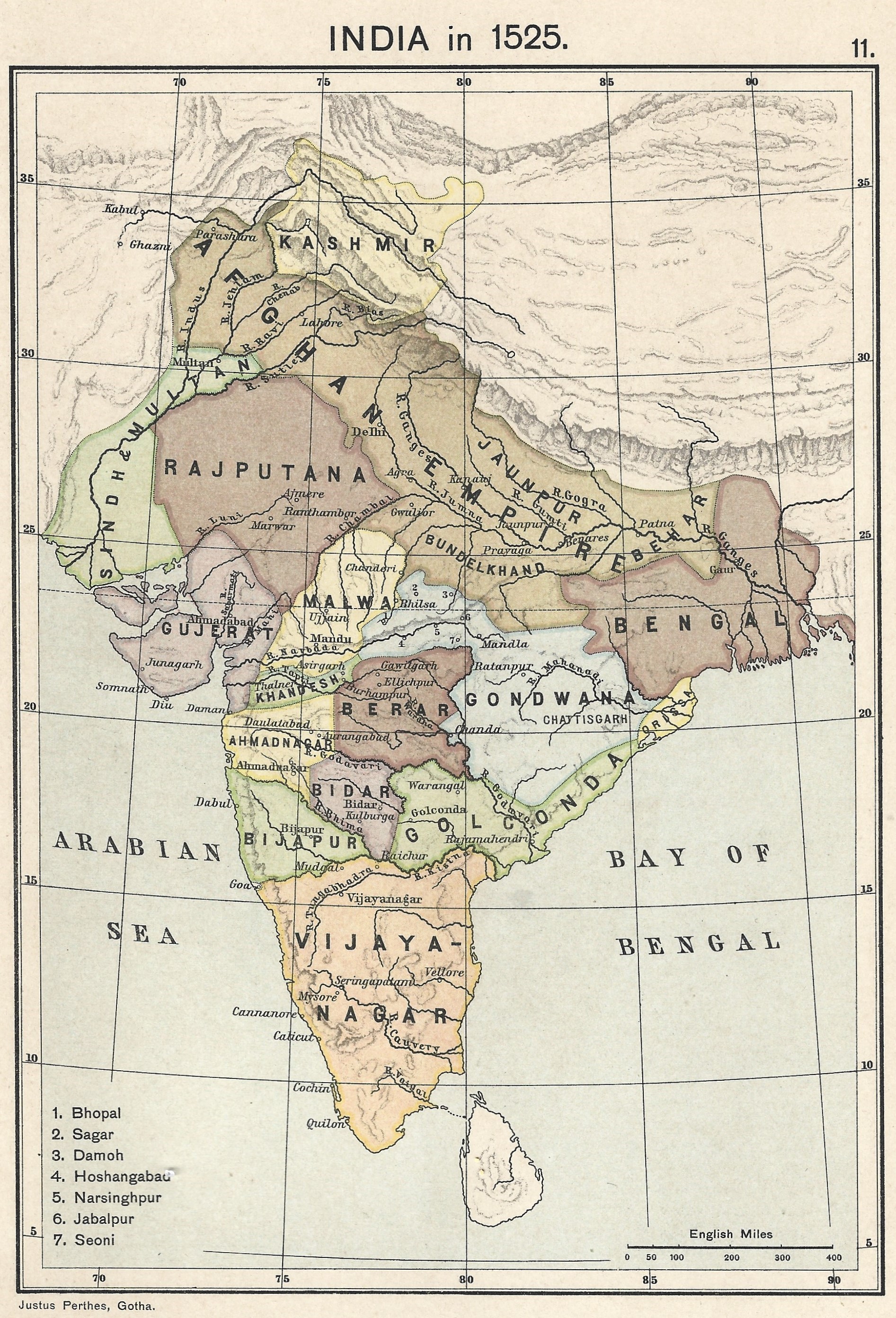
| source | https://upload.wikimedia.org/wikipedia/commons/0/06/Joppen_map-India_in_1525_published_1907_by_Longmans.jpg |
| source:name | India in 1525, Joppe |
| source:tiles | https://mapwarper.net/maps/tile/88795/{z}/{x}/{y}.png |
| start_date | 1128 |
| type | boundary |
| wikidata | Q3929733 |
| wikipedia | en:Rajputana |
Members
19 members
- Way 201034154 as outer
- Way 200813079 as outer
- Way 200813078 as outer
- Way 200805003 as outer
- Way 200805001 as outer
- Way 201034291 as outer
- Way 200792643 as outer
- Way 200804997 as outer
- Way 200813064 as outer
- Way 200805529 as outer
- Way 200805528 as outer
- Way 200792645 as outer
- Way 200792646 as outer
- Way 200805006 as outer
- Way 200805005 as outer
- Way India (200786692) as outer
- Way India (201034151) as outer
- Way India (200813075) as outer
- Way India (201034152) as outer
Welcome to OpenHistoricalMap!
OpenHistoricalMap is an interactive map of the world throughout history, created by people like you and dedicated to the public domain.
OpenHistoricalMap is a charter project of OpenStreetMap U.S., a 501(c)(3) nonprofit organization affiliated with the OpenStreetMap Foundation. Technical development is supported by GreenInfo Network and Development Seed.
| https://www.openhistoricalmap.org/copyright | https://www.openhistoricalmap.org |
| OpenHistoricalMap is dedicated to the public domain except where otherwise noted. | |