Loading...
Way: Aldgate [200 – 1750] (198644311)
Version #2
Little changes mostly on London wall (deleted end_date on still standing wall segments)
Tags
| building | gatehouse |
|---|---|
| end_date | 1750 |
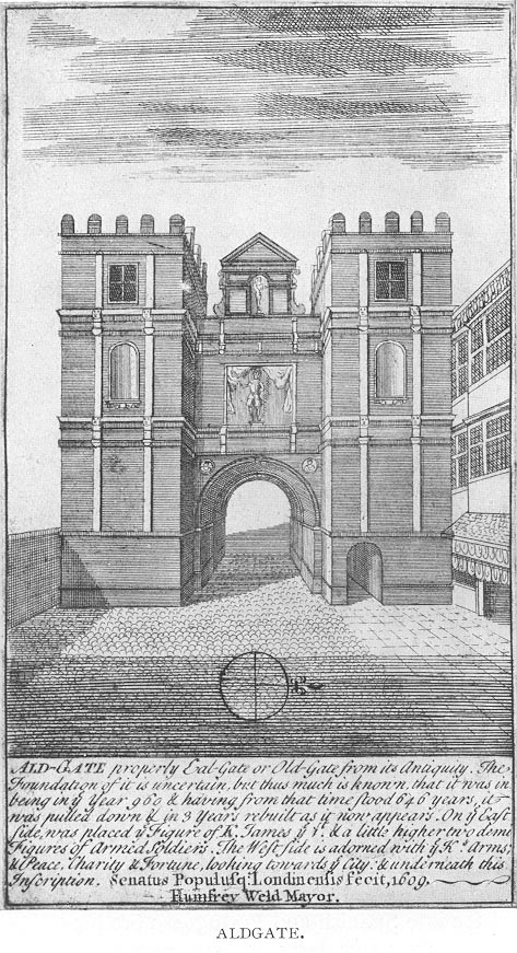
| image:1 | https://upload.wikimedia.org/wikipedia/commons/f/ff/1600_Aldgate.jpg |
| name | Aldgate |
| note | Very rough guess of shape, may not be accurate |
| start_date | 0200 |
Nodes
17 nodes
- 2093276645 (part of way London Wall [200 – 1760] (200388621))
- 2093276653 (part of ways London Wall [200 – 1760] (200388621) and [200 – 1760] (198644312))
- 2093276652 (part of way [200 – 1760] (198644312))
- 2093276644
- 2093276643
- 2093276642 (part of way Aldgate [45 – ] (198591726))
- 2093276641
- 2093276640
- 2093276639
- 2093276647 (part of way London Wall [200 – 1760] (200388621))
- 2093276646 (part of way London Wall [200 – 1760] (200388621))
- 2093276638 (part of way London Wall [200 – 1760] (200388621))
- 2093276637 (part of way London Wall [200 – 1760] (200388621))
- Aldgate [200 – 1750] (2091144121) (part of ways London Wall [200 – 1760] (200388621), Aldgate [45 – ] (198591726), and Aldgate High Street [45 – ] (198591727))
- 2093276635 (part of way London Wall [200 – 1760] (200388621))
- 2093276636 (part of way London Wall [200 – 1760] (200388621))
- 2093276645 (part of way London Wall [200 – 1760] (200388621))
Welcome to OpenHistoricalMap!
OpenHistoricalMap is an interactive map of the world throughout history, created by people like you and dedicated to the public domain.
OpenHistoricalMap is a charter project of OpenStreetMap U.S., a 501(c)(3) nonprofit organization affiliated with the OpenStreetMap Foundation. Technical development is supported by GreenInfo Network and Development Seed.
| https://www.openhistoricalmap.org/copyright | https://www.openhistoricalmap.org |
| OpenHistoricalMap is dedicated to the public domain except where otherwise noted. | |