Loading...
Way: [1964 – ] (198776411)
Version #2
Added places
Tags
| highway | tertiary |
|---|---|
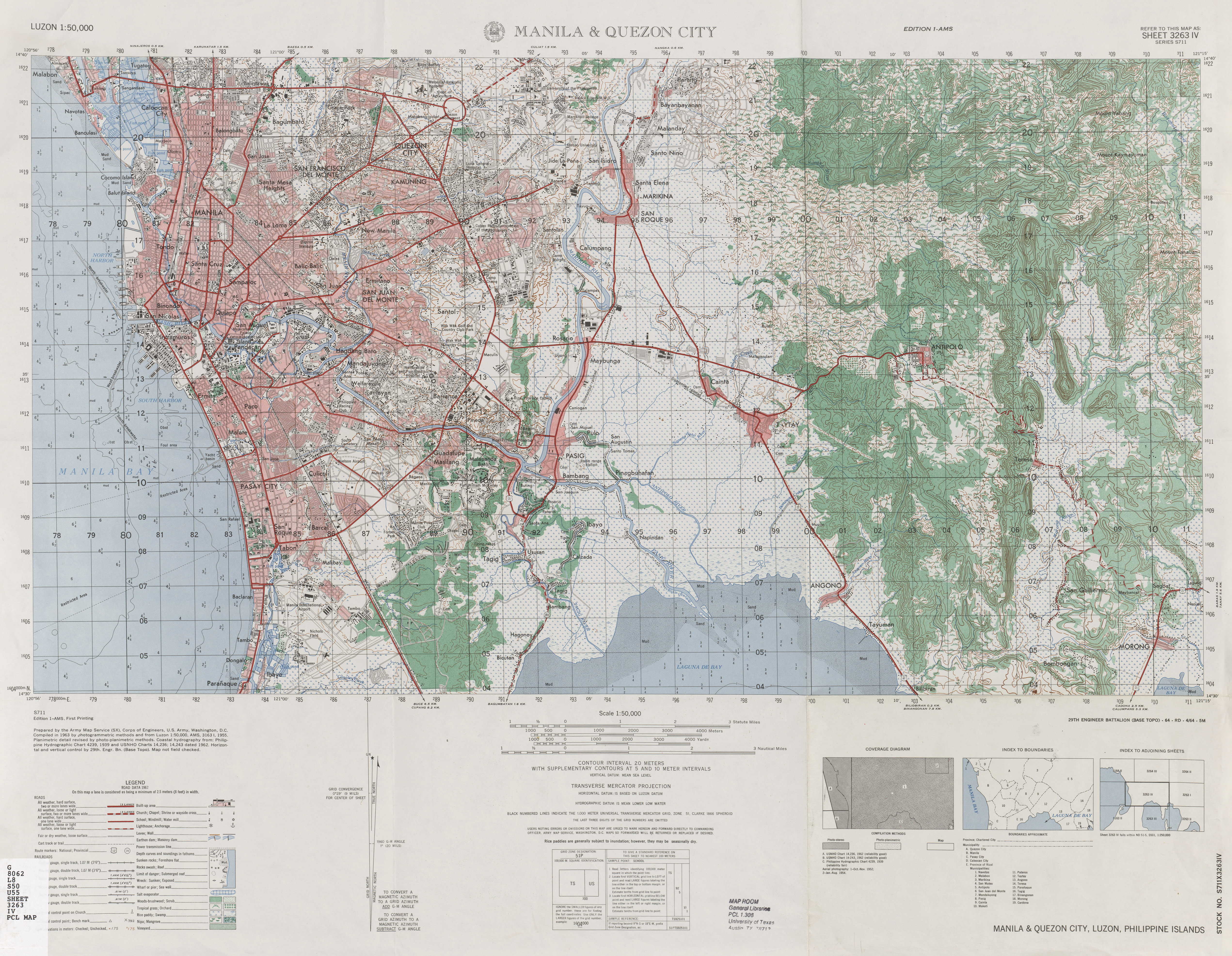
| source | https://maps.lib.utexas.edu/maps/ams/luzon_50k/txu-pclmaps-oclc-10282124-manila-and-quezon-city.jpg |
| start_date | 1964 |
Nodes
32 nodes
- 2090568354 (part of ways EDSA [1997 – ] (198562100) and [1964 – ] (198776383))
- 2095501333 (part of way Paraiso [1966 – ] (198776495))
- 2095501334
- 2095501335
- 2095501336
- 2095501337
- 2095501338
- 2095501156 (part of way [1964 – ] (198776379))
- 2095501339
- 2095501340
- 2095501341 (part of way Lumbang [1966 – ] (198776498))
- 2095501342
- 2095501343
- 2095501344
- 2095501345
- 2095501346
- 2095501347
- 2095501348 (part of way Mahogany [1966 – ] (198776426))
- 2095501349
- 2095501350
- 2095501351
- 2095501352
- 2095501353
- 2095501964 (part of way Gloriasa [1966 – ] (198776446))
- 2095501354
- 2095501355
- 2095501952 (part of way Gladiola [1966 – ] (198776444))
- 2095501356
- 2095501953 (part of way Granada [1968 – ] (198776445))
- 2095501357
- 2095501927 (part of way Gladiola [1966 – ] (198776444))
- 2095501240 (part of way Tamarind [1966 – ] (198776410))
Welcome to OpenHistoricalMap!
OpenHistoricalMap is an interactive map of the world throughout history, created by people like you and dedicated to the public domain.
OpenHistoricalMap is a charter project of OpenStreetMap U.S., a 501(c)(3) nonprofit organization affiliated with the OpenStreetMap Foundation. Technical development is supported by GreenInfo Network and Development Seed.
| https://www.openhistoricalmap.org/copyright | https://www.openhistoricalmap.org |
| OpenHistoricalMap is dedicated to the public domain except where otherwise noted. | |