Loading...
Way: 15th Avenue [1893 – ] (199460350)
Version #1
Added roads in Vancouver
Tags
| highway | residential |
|---|---|
| name | 15th Avenue |
| start_date | 1893 |
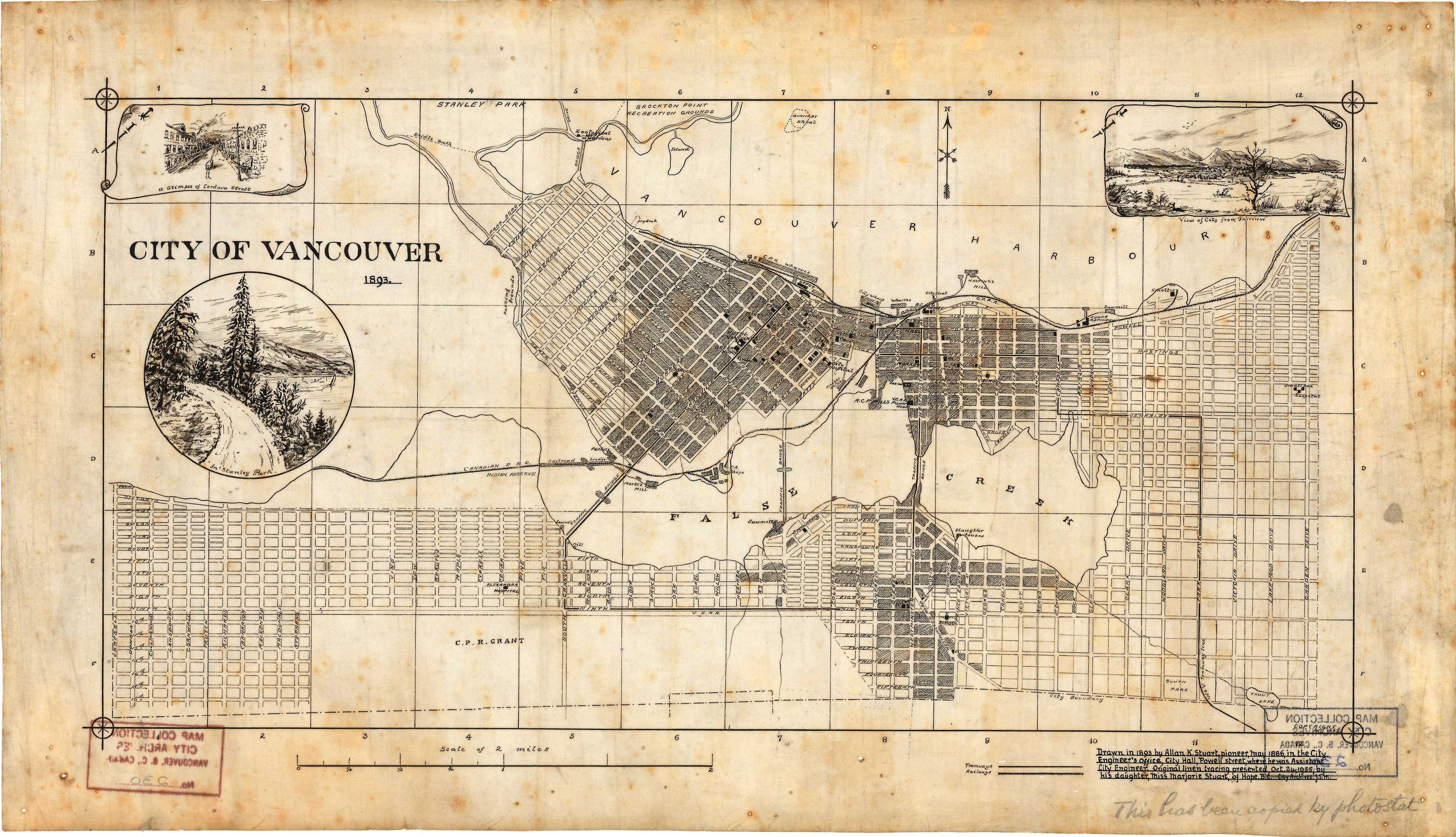
| start_date:source | https://searcharchives.vancouver.ca/uploads/r/null/1/6/1658270/3a1dc810-add9-4d2e-ab44-827b678ec010-MAP230.jpg |
Nodes
9 nodes
- 2097418696 (part of ways [ – 1860] (198930419), 15th Avenue [1909 – ] (199460351), Kingsway [1913 – 1949] (198930420), and [1860 – 1913] (198930427))
- 2101664193 (part of way Kingsway [1949 – ] (198930423))
- 2101664195
- 2101664189
- 2101664190
- 2101664217 (part of way St. Catherines Street [1909 – ] (199242917))
- 2097405396 (part of way Glen Drive [1891 – ] (198929045))
- 2101664191
- 2101664192
Welcome to OpenHistoricalMap!
OpenHistoricalMap is an interactive map of the world throughout history, created by people like you and dedicated to the public domain.
OpenHistoricalMap is a charter project of OpenStreetMap U.S., a 501(c)(3) nonprofit organization affiliated with the OpenStreetMap Foundation. Technical development is supported by GreenInfo Network and Development Seed.
| https://www.openhistoricalmap.org/copyright | https://www.openhistoricalmap.org |
| OpenHistoricalMap is dedicated to the public domain except where otherwise noted. | |