Loading...
Way: [1904 – 1965] (199572725)
Version #3
Agrego varias calles, avenidas y estructuras del centro de Lima
- Edited by El Surquillano
- Changeset #136010
Tags
| electrified | yes |
|---|---|
| end_date | 1965 |
| railway | tram |
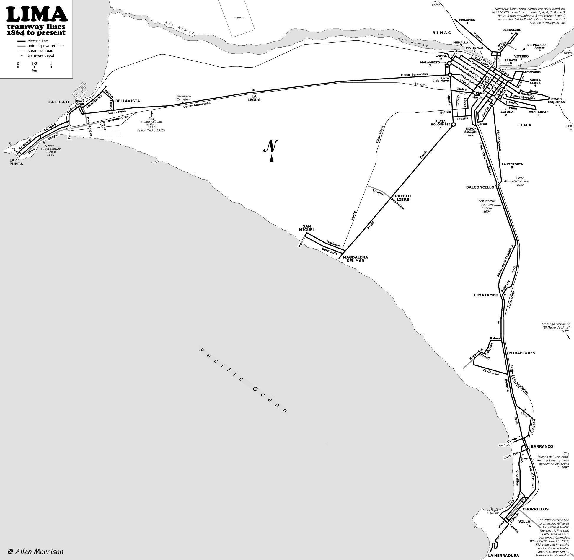
| source | http://www.tramz.com/pe/li/lim.jpg |
| start_date | 1904 |
Nodes
48 nodes
- 2103255319
- 2123273453 (part of way Jirón Junín [1535 – ] (200437949))
- 2123273519 (part of way Jirón Huallaga [1535 – ] (200437957))
- 2103255318
- 2123320778 (part of way Jirón Cusco [1535 – ] (200559339))
- 2103255470 (part of way [1907 – 1965] (199572727))
- 2103255316
- 2103255164 (part of way [1858 – 1934] (199572718))
- 2103255472
- 2103255317 (part of way [1904 – 1965] (200455027))
- 2103255315
- 2103255314
- 2103255230
- 2103255231
- 2103255232
- 2103255233
- 2103255236
- 2103255237
- 2103255238
- 2103255239
- 2103255240
- 2103255242
- 2103255243
- 2103255244
- 2103255245
- 2103255246
- 2103255247
- 2103255248
- 2103255349
- 2103255348
- 2103255249
- 2103255250
- 2103255251
- 2103255252
- 2103255253
- 2103255254
- 2103255255
- 2103255256
- 2103255257
- 2103255258
- 2103255259
- 2103255260
- 2103255261
- 2103255262
- 2103255263
- 2103255264
- 2103255265
- 2103255320 (part of ways [1904 – 1965] (199572726) and [1904 – 1965] (199572728))
Welcome to OpenHistoricalMap!
OpenHistoricalMap is an interactive map of the world throughout history, created by people like you and dedicated to the public domain.
OpenHistoricalMap is a charter project of OpenStreetMap U.S., a 501(c)(3) nonprofit organization affiliated with the OpenStreetMap Foundation. Technical development is supported by GreenInfo Network and Development Seed.
| https://www.openhistoricalmap.org/copyright | https://www.openhistoricalmap.org |
| OpenHistoricalMap is dedicated to the public domain except where otherwise noted. | |