Loading...
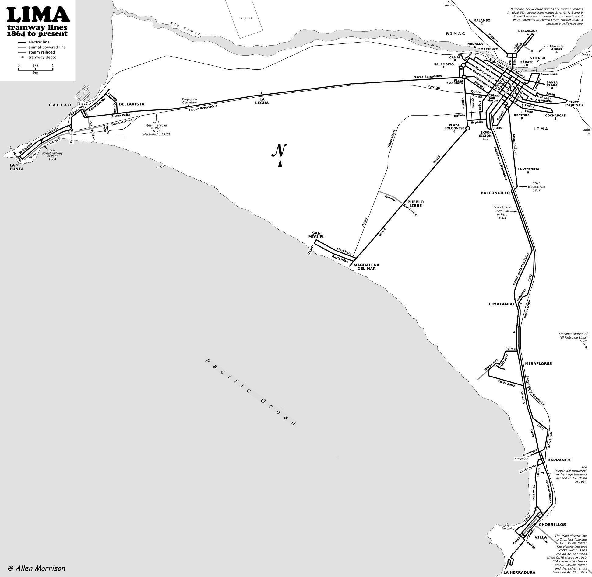
Way: [1904 – 1965] (199572726)
Version #2
Añado calles de Miraflores según plano de 1898
- Edited by El Surquillano
- Changeset #139479
Tags
| electrified | yes |
|---|---|
| end_date | 1965 |
| railway | tram |
| source | http://www.tramz.com/pe/li/lim.jpg |
| start_date | 1904 |
Nodes
29 nodes
- 2103255320 (part of ways [1904 – 1965] (199572728) and [1904 – 1965] (199572725))
- 2103255329
- 2103255321
- 2103255328
- 2103255325
- 2103255327
- 2103255324
- 2103255326
- 2103255322
- 2103255323
- 2103255330
- 2103255331
- 2103255347
- 2103255346
- 2103255332
- 2103255336
- 2103255341
- 2103255337
- 2103255333
- 2103255338
- 2103255339
- 2103255334
- 2103255340
- 2103255343
- 2124589335 (part of way [1890 – ] (200512294))
- 2103255342
- 2103255335
- 2103255344
- 2103255345
Welcome to OpenHistoricalMap!
OpenHistoricalMap is an interactive map of the world throughout history, created by people like you and dedicated to the public domain.
OpenHistoricalMap is a charter project of OpenStreetMap U.S., a 501(c)(3) nonprofit organization affiliated with the OpenStreetMap Foundation. Technical development is supported by GreenInfo Network and Development Seed.
| https://www.openhistoricalmap.org/copyright | https://www.openhistoricalmap.org |
| OpenHistoricalMap is dedicated to the public domain except where otherwise noted. | |