Loading...
Way: [1890 – 1956] (200086872)
Version #2
(no comment)
Tags
| data_type | source |
|---|---|
| electrified | yes |
| end_date | 1956 |
| end_date:note | arbitrary |
| gauge | 1435 |
| gauge:unit | metric |
| network | Pacific Electric |
| quality | 1 |
| railway | tram |
| source:geometry | USGS topoView topographic maps https://ngmdb.usgs.gov/topoview/ |
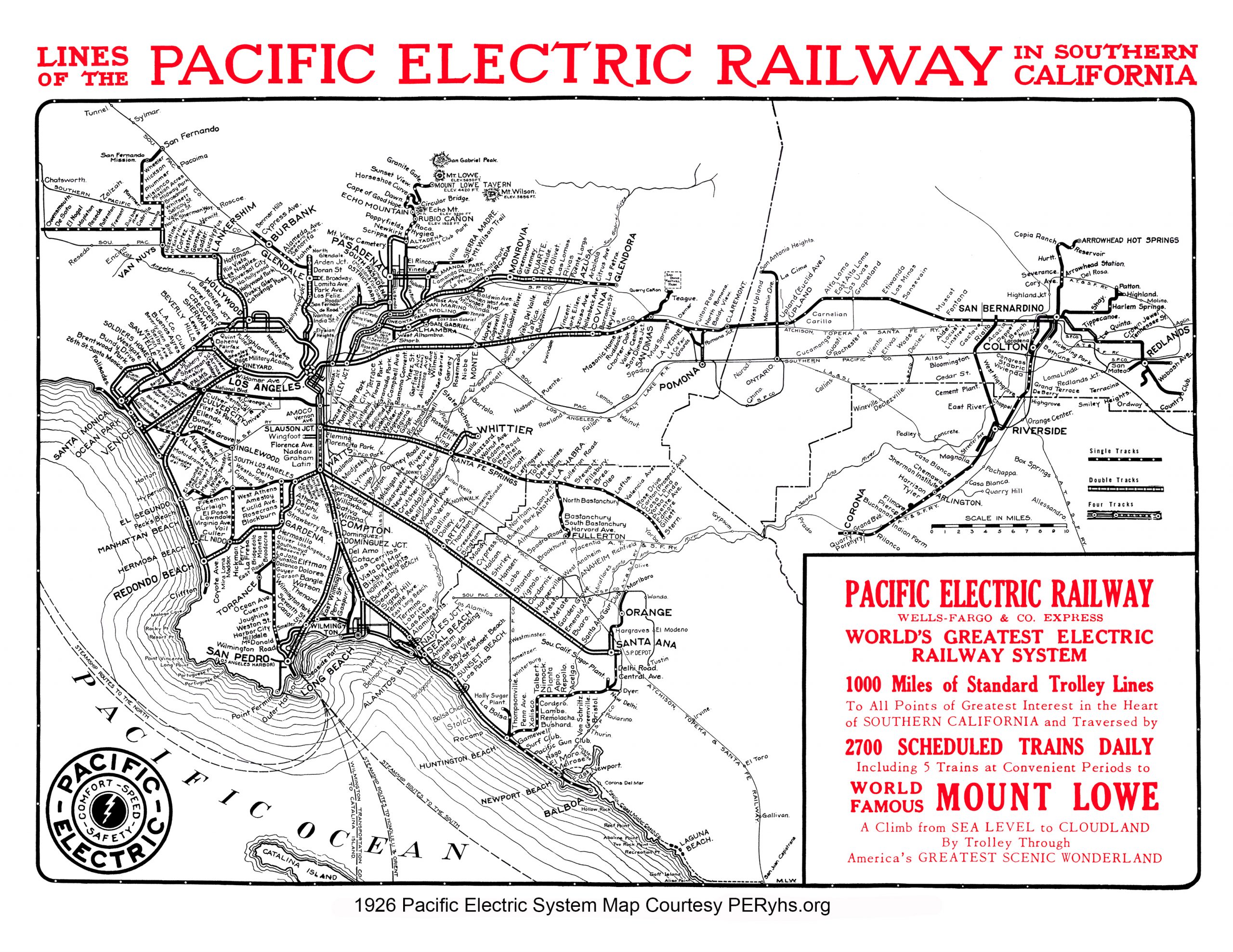
| source:geometry2 | Lines of the Pacific Electric Railway in Southern California (tracks map) https://www.pacificelectric.org/wp-content/uploads/2020/08/pe-system-map-1926-peryhs-scaled.jpg |
| source_type | railway |
| start_date | 1890 |
| start_date:note | arbitrary |
| usage | industrial |
Nodes
23 nodes
- 2115222531
- 2115222544
- 2115222543
- 2115222542
- 2115222541
- 2115222540
- 2115222539
- 2115222538
- 2115222537
- 2115222536
- 2115222535
- 2115222534
- 2115222533 (part of ways 200086871 and 200894213)
- 2115222563 (part of way 200894213)
- 2115222562 (part of way 200894213)
- 2115222561 (part of way 200894213)
- 2115222560 (part of way 200894213)
- 2115222559 (part of way 200894213)
- 2115222558 (part of way 200894213)
- 2115222557 (part of way 200894213)
- 2115222556 (part of way 200894213)
- 2115222555 (part of way 200894213)
-
2115218102
Welcome to OpenHistoricalMap!
OpenHistoricalMap is an interactive map of the world throughout history, created by people like you and dedicated to the public domain.
OpenHistoricalMap is a charter project of OpenStreetMap U.S., a 501(c)(3) nonprofit organization affiliated with the OpenStreetMap Foundation. Technical development is supported by GreenInfo Network and Development Seed.
| https://www.openhistoricalmap.org/copyright | https://www.openhistoricalmap.org |
| OpenHistoricalMap is dedicated to the public domain except where otherwise noted. | |