Loading...
Way: Green Street [1810 – ] (200275510)
Version #1
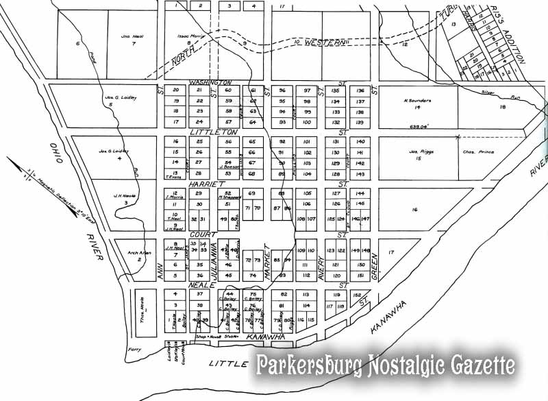
Adding Parkersburg based on original plat
Tags
| highway | residential |
|---|---|
| name | Green Street |
| source | http://www.parkgaz.com/photos/maps/map1817.jpg |
| start_date | 1810 |
Nodes
8 nodes
- 2120737240 (part of way Elizabeth Street [1810 – ] (200275502))
- 2120737241 (part of way Isabella Street [1810 – ] (200275501))
- 2120737242 (part of way Northwestern Turnpike [1827 – 1906] (200275494))
- 2120737184 (part of way Washington Street [1810 – ] (200275500))
- 2120737243 (part of way Littleton Street [1810 – ] (200275499))
- 2120737244 (part of way Harriet Street [1810 – ] (200275498))
- 2120737222 (part of way Court Street [1810 – ] (200275509))
- 2120737190 (part of ways Neale Street [1810 – ] (200275503), Kanawha Street [1810 – ] (200275511), and Kanawha Street [1810 – ] (200275657))
Welcome to OpenHistoricalMap!
OpenHistoricalMap is an interactive map of the world throughout history, created by people like you and dedicated to the public domain.
OpenHistoricalMap is a charter project of OpenStreetMap U.S., a 501(c)(3) nonprofit organization affiliated with the OpenStreetMap Foundation. Technical development is supported by GreenInfo Network and Development Seed.
| https://www.openhistoricalmap.org/copyright | https://www.openhistoricalmap.org |
| OpenHistoricalMap is dedicated to the public domain except where otherwise noted. | |