Loading...
Way: West Fern Street [1894 – ] (200680253)
Version #1
Adding Florida towns
Tags
| highway | residential |
|---|---|
| name | West Fern Street |
| oneway | no |
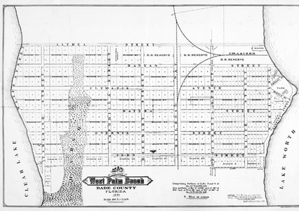
| source | https://upload.wikimedia.org/wikipedia/commons/a/a7/Wbpmap1893.jpg |
| source:name | West Palm Beach |
| start_date | 1894 |
Nodes
9 nodes
- 2126305361 (part of ways East Fern Street [1894 – ] (200680257) and North Biscayne Boulevard [1894 – ] (200586546))
- 2126305390 (part of way South Poinsettia Street [1894 – ] (200680244))
- 2126305362 (part of way Florida East Coast Railway [1896 – ] (200680247))
- 2126305395 (part of way South Railroad Way [1894 – ] (200680243))
- 2126305363 (part of way South Rosemary Street [1894 – ] (200680242))
- 2126305360 (part of way South Sapodilla Street [1894 – ] (200680254))
- 2126305403 (part of way South Tamarind Street [1894 – ] (200680235))
- 2126305399 (part of way Florida Western & Northern Railroad [1925 – ] (200555987))
- 2126305398 (part of way South Water Street [1894 – ] (200680241))
Welcome to OpenHistoricalMap!
OpenHistoricalMap is an interactive map of the world throughout history, created by people like you and dedicated to the public domain.
OpenHistoricalMap is a charter project of OpenStreetMap U.S., a 501(c)(3) nonprofit organization affiliated with the OpenStreetMap Foundation. Technical development is supported by GreenInfo Network and Development Seed.
| https://www.openhistoricalmap.org/copyright | https://www.openhistoricalmap.org |
| OpenHistoricalMap is dedicated to the public domain except where otherwise noted. | |