Loading...
Way: 200701978
Version #3
Tervuren train station
Tags
| quality | 1 |
|---|---|
| source:geometry | Institut géographique militaire/Militair geografisch instituut, Military staff map (available on kbr.be and http://cartesius.be/) |
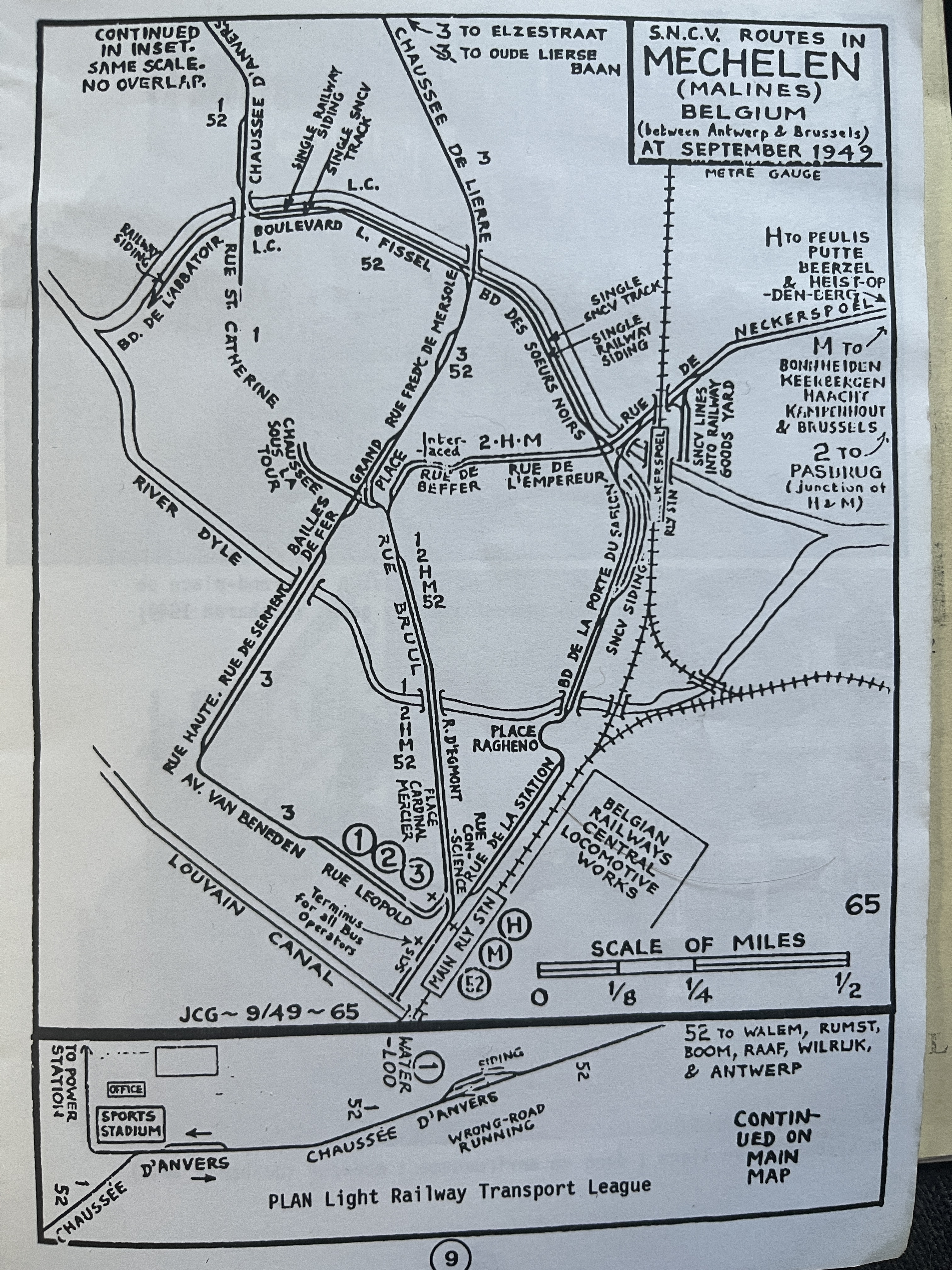
| source:geometry2 | JC Gillham, S.N.C.V. routes in Mechelen (Malines) Belgium (between Antwerp & Brussels) at September 1949 https://i.goopics.net/k5zxlt.jpg |
| source:geometry2:use | railway : tracks geometry |
| source:geometry:use | railway : tracks position |
| source_type | railway |
| type | source |
Nodes
31 nodes
- 2127256065 (part of ways 200726456 and 200726431)
- 2127256064
- 2127256063
- 2127256062
- 2127256061
- 2127256060
- 2127256059
- 2127256058
- 2127256057
- 2127256056
- 2127256055
- 2127256054
- 2127256053
- 2127256052
- 2127256051
- 2127256050
- 2127256049
- 2127256048
- 2127256047
- 2127256046
- 2127256045
- 2127256044
- 2127256043
- 2126741827
- 2126741835 (part of way 200726455)
- 2126741841
- 2126741852
- 2126741849
- 2126741806
- 2126741819
- 2126741826 (part of way 200701900)
Welcome to OpenHistoricalMap!
OpenHistoricalMap is an interactive map of the world throughout history, created by people like you and dedicated to the public domain.
OpenHistoricalMap is a charter project of OpenStreetMap U.S., a 501(c)(3) nonprofit organization affiliated with the OpenStreetMap Foundation. Technical development is supported by GreenInfo Network and Development Seed.
| https://www.openhistoricalmap.org/copyright | https://www.openhistoricalmap.org |
| OpenHistoricalMap is dedicated to the public domain except where otherwise noted. | |