Loading...
Way: 200704983
Version #2
Adding bus routes in Mechelen
Tags
| ! | please do not delete |
|---|---|
| quality | 1 |
| source:geometry | en:guess from photographs nearby. |
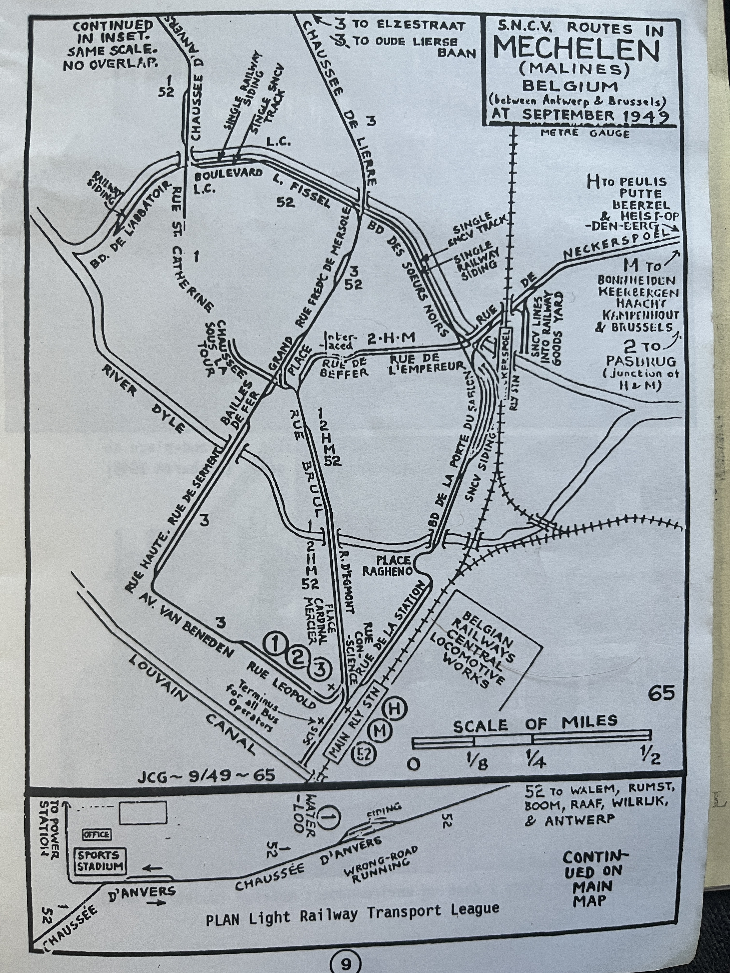
| source:geometry2 | JC Gillham, S.N.C.V. routes in Mechelen (Malines) Belgium (between Antwerp & Brussels) at September 1949 https://i.goopics.net/k5zxlt.jpg |
| source:geometry2:use | railway : tracks geometry |
| source:geometry:guide | Agentschap Digitaal Vlaanderen (ADV), Grootschalig Referentiebestand/Basiskaart Vlaanderen (GRB) |
| source:geometry:use | railway : tracks position |
| source_type | railway |
| type | source |
Nodes
6 nodes
- 2126813442 (part of ways 200704982 and 200705040)
- 2126813437
- 2126813438
- 2126813439
- 2126813441
-
2126813028
Welcome to OpenHistoricalMap!
OpenHistoricalMap is an interactive map of the world throughout history, created by people like you and dedicated to the public domain.
OpenHistoricalMap is a charter project of OpenStreetMap U.S., a 501(c)(3) nonprofit organization affiliated with the OpenStreetMap Foundation. Technical development is supported by GreenInfo Network and Development Seed.
| https://www.openhistoricalmap.org/copyright | https://www.openhistoricalmap.org |
| OpenHistoricalMap is dedicated to the public domain except where otherwise noted. | |