Loading...
Way: [1910 – 1945] (200709609)
Version #2
added images
- Edited by CuratorOfThePast
- Changeset #181334
Tags
| building | yes |
|---|---|
| end_date | 1945 |
| end_date:source | HistoMap Berlin |
| image:1 | https://sammlung-online.stadtmuseum.de/large/483/f94354ff-10bb-4814-8c40-8724e496fcf5.jpg |
| image:2 | https://sammlung-online.stadtmuseum.de/large/16/d1154f47-6c9e-4b26-8280-ace3cfc9b69a.jpg |
| source:1:date | 1900 |
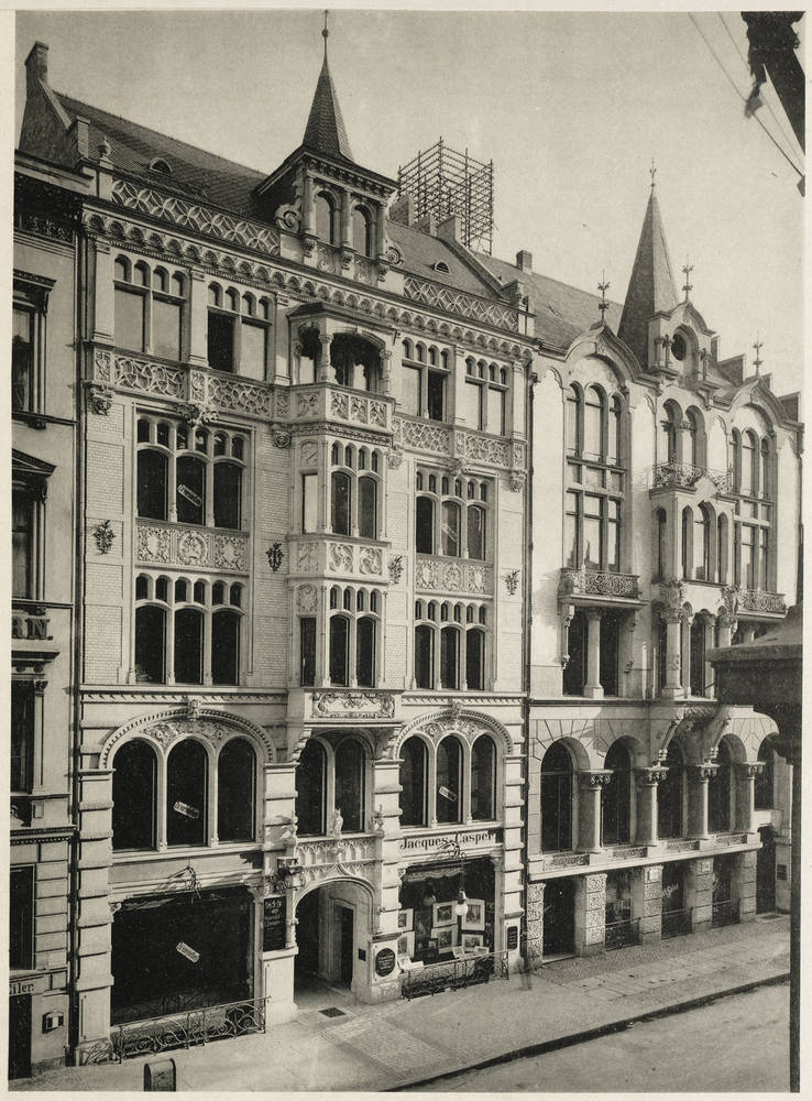
| source:1:name | Kauf- und Wohnhaus in Berlin, Behrenstraße 17. |
| source:1:url | https://sammlung-online.stadtmuseum.de/Details/Index/258245 |
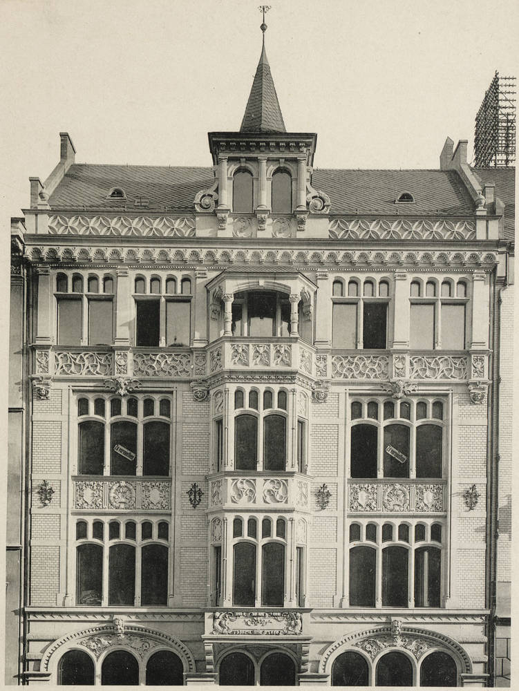
| source:date | 1900 |
| source:name | Kauf- und Wohnhaus in Berlin, Behrenstraße 17. |
| source:url | https://sammlung-online.stadtmuseum.de/Details/Index/258244 |
| start_date | 1910 |
| start_date:edtf | /1910 |
| start_date:source | Straubeplan |
Nodes
12 nodes
- 2126875444 (part of way [1910 – 1945] (200709608))
- 2096545646 (part of ways 198836010 and 198836010)
- 2096545652 (part of ways 198836010 and 200709251)
- 2126875459 (part of way 200709251)
- 2126875460
- 2126875461 (part of way [1910 – 1945] (200709608))
- 2126875462 (part of way [1910 – 1945] (200709608))
- 2126875463
- 2126875464
- 2126875465
- 2126875466 (part of way [1910 – 1945] (200709608))
- 2126875444 (part of way [1910 – 1945] (200709608))
Welcome to OpenHistoricalMap!
OpenHistoricalMap is an interactive map of the world throughout history, created by people like you and dedicated to the public domain.
OpenHistoricalMap is a charter project of OpenStreetMap U.S., a 501(c)(3) nonprofit organization affiliated with the OpenStreetMap Foundation. Technical development is supported by GreenInfo Network and Development Seed.
| https://www.openhistoricalmap.org/copyright | https://www.openhistoricalmap.org |
| OpenHistoricalMap is dedicated to the public domain except where otherwise noted. | |