Loading...
Way: Bohlweg [1160 – ] (200714312)
Version #1
Add Bohlweg and Löwenwall (formerly Monumentplatz)
Tags
| alt_name | Bohl Wegeh |
|---|---|
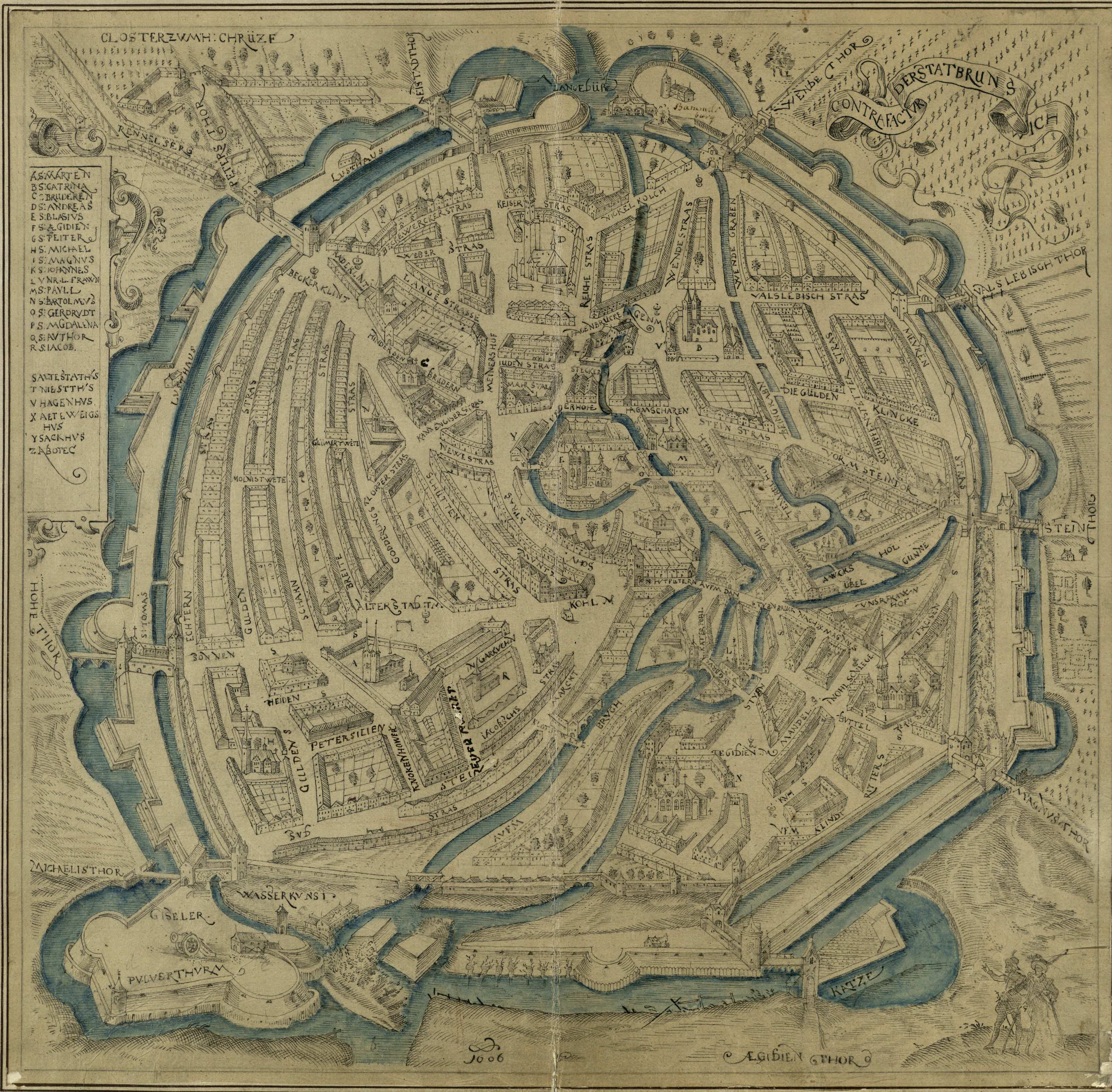
| alt_name:source | https://upload.wikimedia.org/wikipedia/commons/2/21/Braunschweig_1606.jpg |
| highway | primary |
| name | Bohlweg |
| start_date | 1160 |
| start_date:source | https://www.der-loewe.info/vom-mittelalterlichen-bohlenweg-zur-repraesentativen-achse |
Nodes
4 nodes
- 2126973121 (part of way Fallersleber Straße [1239 – ] (200714466))
- 2126973122 (part of way Steinweg [1300 – ] (200714465))
- 2126973123
- 2126973124
Welcome to OpenHistoricalMap!
OpenHistoricalMap is an interactive map of the world throughout history, created by people like you and dedicated to the public domain.
OpenHistoricalMap is a charter project of OpenStreetMap U.S., a 501(c)(3) nonprofit organization affiliated with the OpenStreetMap Foundation. Technical development is supported by GreenInfo Network and Development Seed.
| https://www.openhistoricalmap.org/copyright | https://www.openhistoricalmap.org |
| OpenHistoricalMap is dedicated to the public domain except where otherwise noted. | |