Loading...
Way: 200790330
Version #2
rough pass at India watershed cleanup; much more work to be done
Tags
| border | yes |
|---|---|
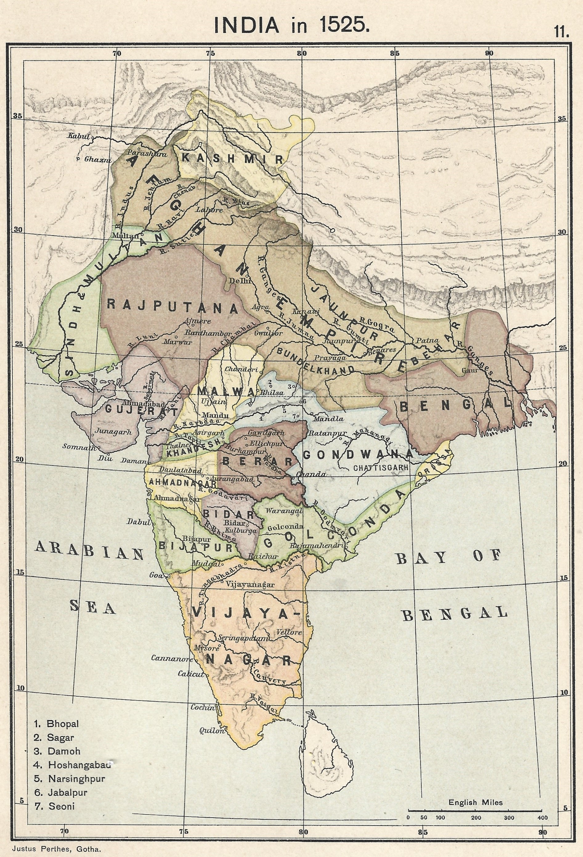
| source | https://upload.wikimedia.org/wikipedia/commons/0/06/Joppen_map-India_in_1525_published_1907_by_Longmans.jpg |
| source:name | India in 1525, Joppe |
| source:tiles | https://mapwarper.net/maps/tile/88795/{z}/{x}/{y}.png |
Nodes
57 nodes
- 2128331576
- 2128331575
- 2128331574
- 2128331573
- 2128331572
- 2128331571
- 2128331570
- 2128331569
- 2128331568
- 2128331567
- 2128331566
- 2128331565
- 2128331564
- 2128331563
- 2128331562
- 2128331561
- 2128331560
- 2128331559
- 2128331558
- 2128331557
- 2128331556
- 2128331555
- 2128331554
- 2128331553
- 2128331552
- 2128331551
- 2128331550
- 2128331549
- 2128331548
- 2128331547
- 2128331546
- 2128331545
- 2128331544
- 2128331543
- 2128331542
- 2128331541
- 2128331540
- 2128331539
- 2128331538
- 2128331537
- 2128331536
- 2128331535
- 2128331534
- 2128331533
- 2128331532
- 2128331531
- 2128331530
- 2128331529
- 2128331528
- 2128331527
- 2128331526
- 2128331525
- 2128331524
- 2128331523
- 2128331522
- 2128331521
- 2128331520
Welcome to OpenHistoricalMap!
OpenHistoricalMap is an interactive map of the world throughout history, created by people like you and dedicated to the public domain.
OpenHistoricalMap is a charter project of OpenStreetMap U.S., a 501(c)(3) nonprofit organization affiliated with the OpenStreetMap Foundation. Technical development is supported by GreenInfo Network and Development Seed.
| https://www.openhistoricalmap.org/copyright | https://www.openhistoricalmap.org |
| OpenHistoricalMap is dedicated to the public domain except where otherwise noted. | |