Loading...
Way: Fort Street [1861 – ] (200827524)
Version #1
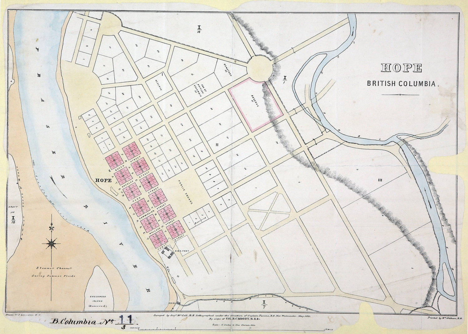
Added roads in Hope, BC
Tags
| highway | unclassified |
|---|---|
| name | Fort Street |
| start_date | 1861 |
| start_date:source | https://hcmc.uvic.ca/~coldesp/maps/maps_lg/co_700-bc_11_3_hope_1861.jpg |
Nodes
4 nodes
- 2129276150 (part of way [1861 – ] (200827523))
- 2129276213 (part of way [1861 – ] (200827544))
- 2129276173 (part of way Fraser [1861 – ] (200827532))
- 2129276151 (part of way [1861 – ] (200827533))
Welcome to OpenHistoricalMap!
OpenHistoricalMap is an interactive map of the world throughout history, created by people like you and dedicated to the public domain.
OpenHistoricalMap is a charter project of OpenStreetMap U.S., a 501(c)(3) nonprofit organization affiliated with the OpenStreetMap Foundation. Technical development is supported by GreenInfo Network and Development Seed.
| https://www.openhistoricalmap.org/copyright | https://www.openhistoricalmap.org |
| OpenHistoricalMap is dedicated to the public domain except where otherwise noted. | |