Loading...
Way: Serra Street [1888 – ] (200910505)
Version #2
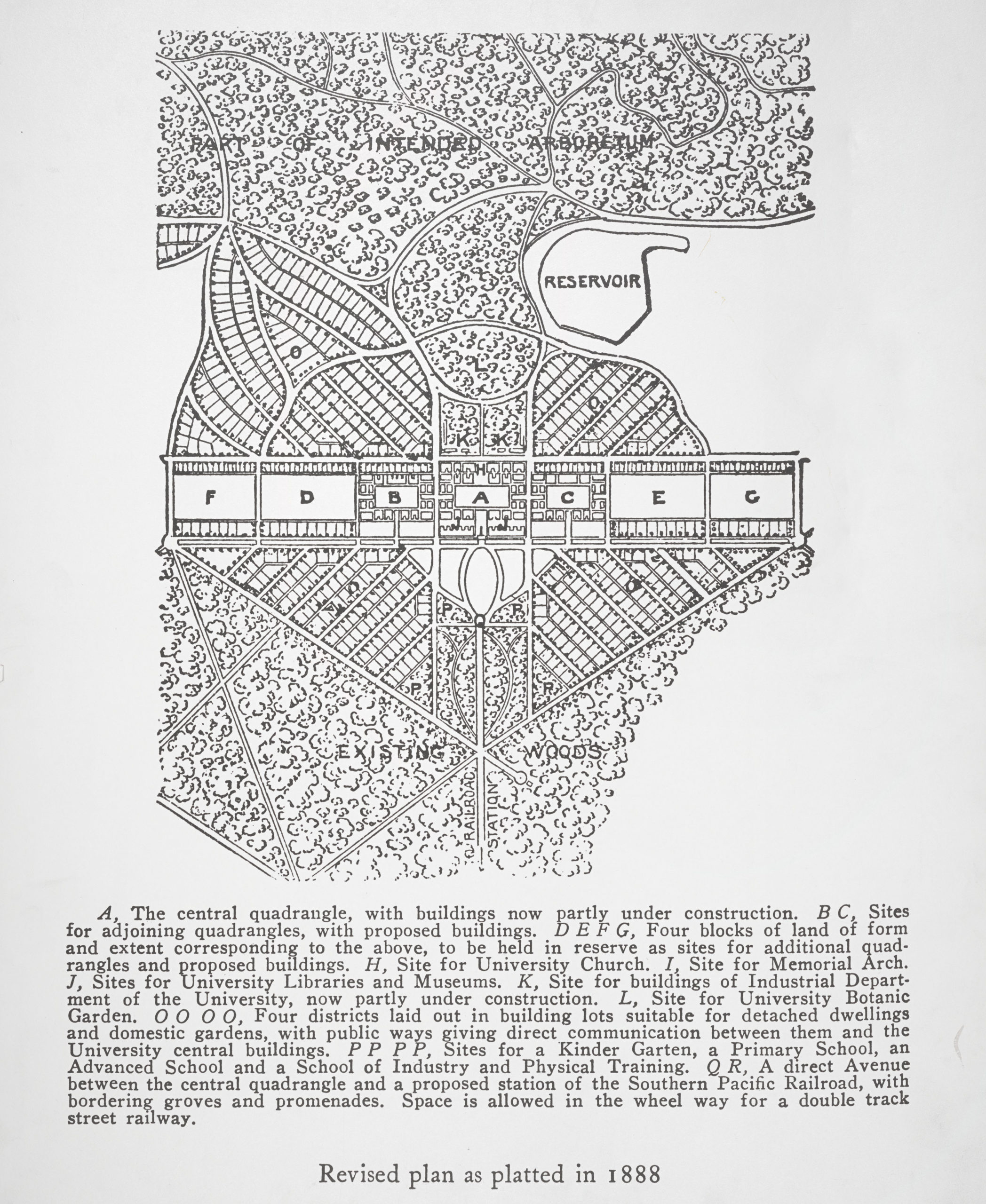
Adding original Olmsted plan of Stanford Univ.
Tags
| highway | secondary |
|---|---|
| import | lsju_streets |
| license | public domain |
| maxspeed | 25 |
| name | Serra Street |
| oneway | yes |
| source | https://olmsted.org/wp-content/uploads/2023/06/1888_tq202tg1812_00_0001-scaled-1.jpg |
| source:featuid | 1.6500082E7 |
| source:name | Olmsted Plan of Stanford University, 1888 |
| source:objectid | 40738.0 |
| start_date | 1888-02-29 |
| surface | asphalt |
Nodes
15 nodes
- 2131203719 (part of way Northeast Circle [1888 – ] (200910522))
- 2131203566 (part of way [1888 – ] (200910500))
- 2131203569 (part of way [1888 – ] (200910501))
- 2103254460 (part of way [1888 – ] (200910497))
- 2131203514 (part of ways [1888 – ] (199577596), [1888 – ] (200910518), and [1888 – ] (200910518))
- 2103253429 (part of ways [1888 – ] (200910492) and [1888 – ] (200910518))
- 2103254054 (part of ways [1888 – ] (200910486) and [1888 – ] (200910518))
- 2131203582 (part of ways University Avenue [1888 – ] (200910481), University Avenue [1888 – ] (200910507), University Avenue [1888 – ] (199572005), and [1888 – ] (200910518))
- 2103310414 (part of ways [1888 – ] (200910493) and [1888 – ] (200910518))
- 2131203605 (part of ways [1888 – ] (200910484) and [1888 – ] (200910518))
- 2103254664 (part of ways [1888 – ] (199577597), [1925 – ] (200910528), and [1888 – ] (200910518))
- 2131203607 (part of ways [1888 – ] (200910511) and [1925 – ] (200910528))
- 2131203611 (part of ways [1888 – ] (200910513) and [1925 – ] (200910528))
- 2131203609 (part of ways [1888 – ] (200910512) and [1925 – ] (200910528))
- 2131203599 (part of way Northwest Circle [1888 – ] (200910508))
Welcome to OpenHistoricalMap!
OpenHistoricalMap is an interactive map of the world throughout history, created by people like you and dedicated to the public domain.
OpenHistoricalMap is a charter project of OpenStreetMap U.S., a 501(c)(3) nonprofit organization affiliated with the OpenStreetMap Foundation. Technical development is supported by GreenInfo Network and Development Seed.
| https://www.openhistoricalmap.org/copyright | https://www.openhistoricalmap.org |
| OpenHistoricalMap is dedicated to the public domain except where otherwise noted. | |