Loading...
Way: Grad Goričane [1631 – ] (200921607)
Version #2
Medvode, Smlednik, Goričane
- Edited by Janez Pavel Žebovec
- Changeset #180005
Tags
| access | permit |
|---|---|
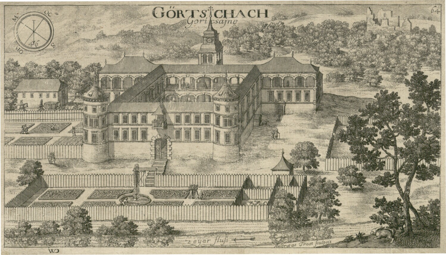
| alt_name:de | Görtschach |
| building | yes |
| castle_type | manor |
| historic | castle |
| historic:civilization | medieval |
| image | https://upload.wikimedia.org/wikipedia/commons/5/5c/Valvasor_-_Dvorec_in_grad_Gori%C4%8Dane.jpg |
| name | Grad Goričane |
| source:url | Grad Goričane |
| start_date | 1631 |
| wikidata | Q12790224 |
| wikipedia | sl:Grad Goričane |
Nodes
11 nodes
- 2131343593 (part of way Grad Goričane [1664 – 1831] (201138161))
- 2136096401 (part of way Grad Goričane [1664 – 1831] (201138161))
- 2131343594 (part of way Grad Goričane [1664 – 1831] (201138161))
- 2131343595 (part of way Grad Goričane [1664 – 1831] (201138161))
- 2136096400 (part of way Grad Goričane [1664 – 1831] (201138161))
- 2131343596 (part of way Grad Goričane [1664 – 1831] (201138161))
- 2131343597 (part of way Grad Goričane [1664 – 1831] (201138161))
- 2131343598 (part of way Grad Goričane [1664 – 1831] (201138161))
- 2131343599 (part of way Grad Goričane [1664 – 1831] (201138161))
- 2131343600 (part of ways Grad Goričane [1664 – 1831] (201138161) and Grad Goričane [1664 – 1831] (201138161))
- 2131343593 (part of way Grad Goričane [1664 – 1831] (201138161))
Welcome to OpenHistoricalMap!
OpenHistoricalMap is an interactive map of the world throughout history, created by people like you and dedicated to the public domain.
OpenHistoricalMap is a charter project of OpenStreetMap U.S., a 501(c)(3) nonprofit organization affiliated with the OpenStreetMap Foundation. Technical development is supported by GreenInfo Network and Development Seed.
| https://www.openhistoricalmap.org/copyright | https://www.openhistoricalmap.org |
| OpenHistoricalMap is dedicated to the public domain except where otherwise noted. | |