Loading...
Way: Kokrški most [1960 – ] (200939528)
Version #2
Kranj
- Edited by Janez Pavel Žebovec
- Changeset #168855
Tags
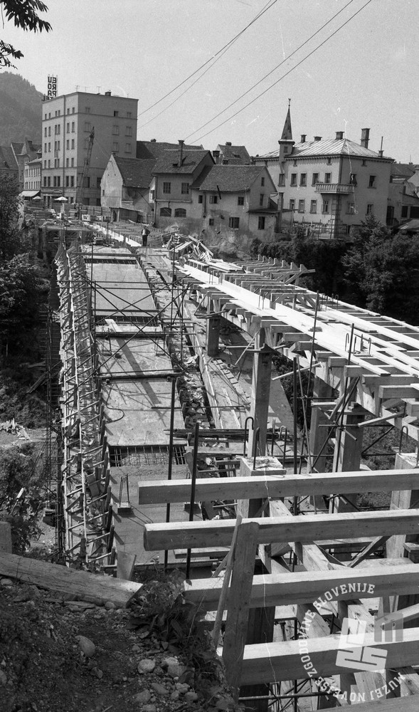
| architect | Miloš Miklič |
|---|---|
| image:1 | https://siol.net/media/images/2017-09/de1661_8.jpg |
| image:2 | https://i0.wp.com/homocumolat.com/wp-content/uploads/2023/06/Gradnja-mostu-cez-Kokro.jpg?w=960&ssl=1 |
| image:2:date | 18XX |
| image:2:source:url | https://homocumolat.com/2023/07/05/foto-dokument-kranj-nekoc-1850-1968/ |
| layer | 1 |
| man_made | bridge |
| name | Kokrški most |
| source:name | Kamra - Mostovi Kranja |
| source:url | https://www.kamra.si/digitalne-zbirke/mostovi-kranja/ |
| start_date | 1960 |
Nodes
7 nodes
- 2131597751
- 2131597755 (part of ways Poštna ulica (200939530) and Poštna ulica (200933439))
- 2131597752
- 2131597753
- 2131597766 (part of way Poštna ulica (200939530))
- 2131597754
- 2131597751
Welcome to OpenHistoricalMap!
OpenHistoricalMap is an interactive map of the world throughout history, created by people like you and dedicated to the public domain.
OpenHistoricalMap is a charter project of OpenStreetMap U.S., a 501(c)(3) nonprofit organization affiliated with the OpenStreetMap Foundation. Technical development is supported by GreenInfo Network and Development Seed.
| https://www.openhistoricalmap.org/copyright | https://www.openhistoricalmap.org |
| OpenHistoricalMap is dedicated to the public domain except where otherwise noted. | |