Loading...
Way: Seymour Street [1915 – ] (200964484)
Version #1
Adding Watertown NY
Tags
| highway | residential |
|---|---|
| name | Seymour Street |
| oneway | no |
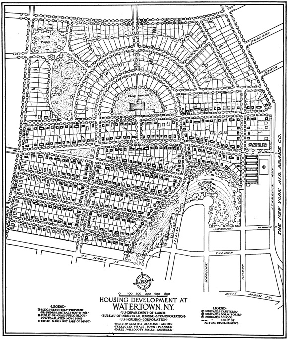
| source | https://web.mit.edu/ebj/www/ww1/images/Watertown1.jpg |
| source:name | Watertown Site |
| source:url | U.S. Housing Corporation - U.S. Department of Labor |
| start_date | 1915 |
Nodes
3 nodes
- 2131958282 (part of ways Katherine Street [1915 – ] (200964490) and [1915 – ] (200964493))
- 2131958260 (part of ways Lansing Street [1915 – ] (200964488), [1915 – ] (200964493), and [1915 – ] (200964493))
- 2131958276 (part of ways Cleveland Street [1915 – ] (200964483), Northeast Park [1915 – ] (200964486), and [1915 – ] (200964494))
Welcome to OpenHistoricalMap!
OpenHistoricalMap is an interactive map of the world throughout history, created by people like you and dedicated to the public domain.
OpenHistoricalMap is a charter project of OpenStreetMap U.S., a 501(c)(3) nonprofit organization affiliated with the OpenStreetMap Foundation. Technical development is supported by GreenInfo Network and Development Seed.
| https://www.openhistoricalmap.org/copyright | https://www.openhistoricalmap.org |
| OpenHistoricalMap is dedicated to the public domain except where otherwise noted. | |