Loading...
Way: [1909 – ] (201037513)
Version #1
Added roads in Modena, Italy
Tags
| highway | tertiary |
|---|---|
| start_date | 1909 |
| start_date:edtf | ..1909 |
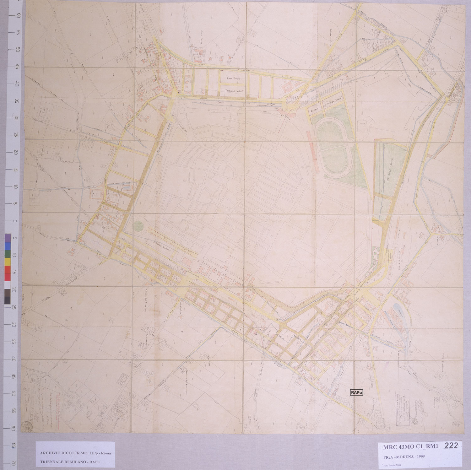
| start_date:source | Piano regolatore e di ampliamento di Modena, 1909 (https://www.rapu.it/ricerca/jpg/222.jpg) |
Nodes
12 nodes
- 2134824175 (part of way [1909 – ] (201037373))
- 2134824218 (part of way [1829 – ] (201037531))
- 2134824183 (part of way [1909 – ] (201037515))
- 2134824186 (part of way [1909 – ] (201037516))
- 2134824188 (part of way [1909 – ] (201037517))
- 2134824190 (part of way [1909 – ] (201037518))
- 2134824198 (part of way [1909 – ] (201037522))
- 2134824197 (part of way [1909 – ] (201037521))
- 2134824195 (part of way [1909 – ] (201037520))
- 2134824176
- 2134824177
- 2134824178 (part of way [1829 – ] (201029748))
Welcome to OpenHistoricalMap!
OpenHistoricalMap is an interactive map of the world throughout history, created by people like you and dedicated to the public domain.
OpenHistoricalMap is a charter project of OpenStreetMap U.S., a 501(c)(3) nonprofit organization affiliated with the OpenStreetMap Foundation. Technical development is supported by GreenInfo Network and Development Seed.
| https://www.openhistoricalmap.org/copyright | https://www.openhistoricalmap.org |
| OpenHistoricalMap is dedicated to the public domain except where otherwise noted. | |