Loading...
Way: Via Cinta [1943 – ] (201071761)
Version #1
Added roads in Libya
Tags
| highway | tertiary |
|---|---|
| name | Via Cinta |
| start_date | 1943 |
| start_date:edtf | ..1943 |
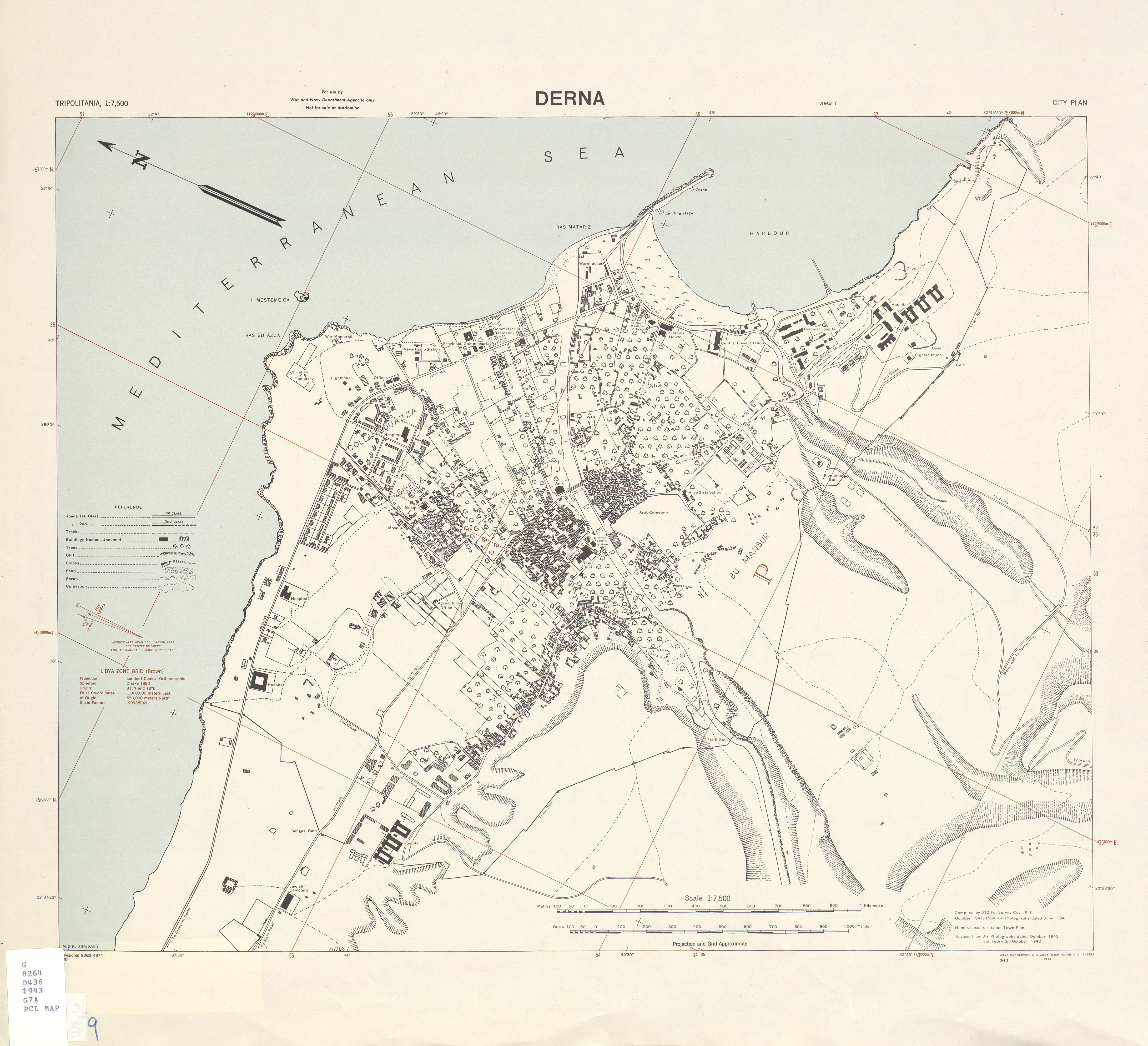
| start_date:source | https://maps.lib.utexas.edu/maps/ams/tripolitania_city_plans/txu-oclc-6588933.jpg |
Nodes
8 nodes
- 2135274417 (part of way Via Littoria [1943 – ] (201071752))
- 2135274424
- 2135274431 (part of way Via dell'Acqua [1943 – ] (201071756))
- 2135274425
- 2135274426
- 2135274439 (part of way Via San Francesco [1943 – ] (201071757))
- 2135274427
- 2135274428 (part of ways Via XVII Ottobre [1943 – ] (201071755) and Via Duca degli Abruzzi [1943 – ] (201071758))
Welcome to OpenHistoricalMap!
OpenHistoricalMap is an interactive map of the world throughout history, created by people like you and dedicated to the public domain.
OpenHistoricalMap is a charter project of OpenStreetMap U.S., a 501(c)(3) nonprofit organization affiliated with the OpenStreetMap Foundation. Technical development is supported by GreenInfo Network and Development Seed.
| https://www.openhistoricalmap.org/copyright | https://www.openhistoricalmap.org |
| OpenHistoricalMap is dedicated to the public domain except where otherwise noted. | |