Loading...
Way: I-64 [1973 – ] (201123299)
Version #2
Extended I-64 to the northwestern edge of Fayette County.
- Edited by Ben Colclough
- Changeset #179332
Tags
| highway | motorway |
|---|---|
| name | I-64 |
| ref | I-64 |
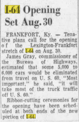
| source | I-64 Opening Set Aug. 30 |
| source:date | August 9, 1973 |
| source:name | The Lexington Leader |
| source:url | https://i.postimg.cc/1tGQd0z8/I64.png |
| start_date | 1973-08-30 |
Nodes
67 nodes
- 2135968166 (part of ways 199752725 and I-64 [1973 – ] (201129237))
- 2135968165
- 2135968164
- 2135968163
- 2135968162
- 2135968161
- 2135968160
- 2135968159
- 2135968158
- 2135968157
- 2135968156
- 2135968155
- 2135968154
- 2135968153
- 2135968152
- 2135968151
- 2135968150
- 2135968149
- 2135968148
- 2135968147
- 2135968146
- 2135968145
- 2135968144
- 2135968143
- 2135968142
- 2135968141
- 2135968140
- 2135968139
- 2135968138
- 2135968137
- 2135968136
- 2135968135
- 2135968134
- 2135968133
- 2135968132
- 2135968131
- 2135968130
- 2135968129
- 2135581780
- 2135581781
- 2135581782
- 2135581783
- 2135581784
- 2135581787
- 2135581788
- 2135581789 (part of way [1973 – ] (201123285))
- 2135581790
- 2135581791
- 2135581792
- 2135581793
- 2135581794
- 2135581795
- 2135581796
- 2135581797
- 2135581798
- 2135581799
- 2135581800
- 2135581801
- 2135581802
- 2135581803
- 2135581804
- 2135581805
- 2135581806
- 2135581807
- 2135581808
- 2135581809
- 2135581810 (part of ways [1964 – ] (201123296) and I-64 / I-75 [1964 – ] (201107685))
Welcome to OpenHistoricalMap!
OpenHistoricalMap is an interactive map of the world throughout history, created by people like you and dedicated to the public domain.
OpenHistoricalMap is a charter project of OpenStreetMap U.S., a 501(c)(3) nonprofit organization affiliated with the OpenStreetMap Foundation. Technical development is supported by GreenInfo Network and Development Seed.
| https://www.openhistoricalmap.org/copyright | https://www.openhistoricalmap.org |
| OpenHistoricalMap is dedicated to the public domain except where otherwise noted. | |