Loading...
Way: [1966 – ] (201124680)
Version #1
Added New Circle Road between Versailles Road and Harrodsburg Road, Lexington, Kentucky.
- Edited by Ben Colclough
- Changeset #179087
Tags
| highway | motorway |
|---|---|
| source | Map of West Lexington |
| source:date | 1971 |
| source:name | USGS |
| source:url | https://ngmdb.usgs.gov/ht-bin/tv_browse.pl?id=4a1493af4afaa8fdb1383fe4bbc5ab41 |
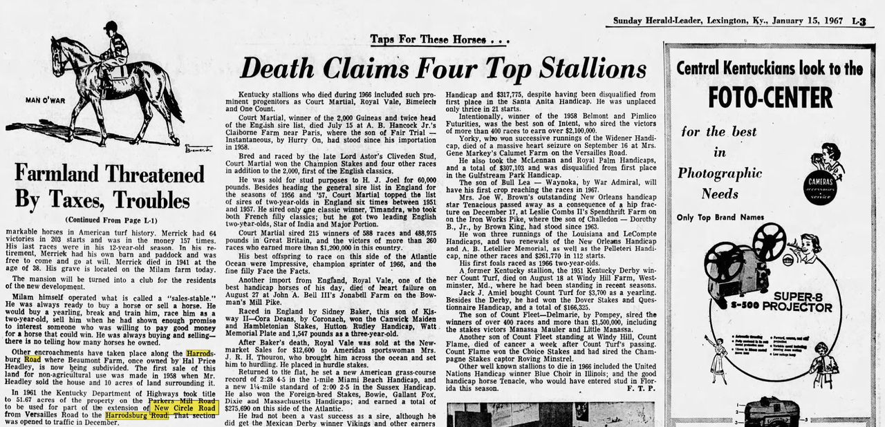
| start_date | 1966-12 |
| start_date:source | https://i.postimg.cc/1zL5jxy0/new-circle-versallies-harrodsburg.png |
Nodes
17 nodes
- 2135559143 (part of ways Versailles Road (US 60) [1964 – ] (201140716), Versailles Road [1890 – 1964] (201140718), and Frankfort, Versailles & Lexington Turnpike [1830 – 1890] (201140714))
- 2135902337
- 2135902338
- 2135902339
- 2135902340
- 2135902341
- 2135902342
- 2135902343
- 2135902344
- 2135902345
- 2135902346
- 2135902347
- 2135902348
- 2135902349
- 2135902350
- 2135902351
- 2135902352 (part of way New Circle Road (KY 4) [1966 – ] (201124665))
Welcome to OpenHistoricalMap!
OpenHistoricalMap is an interactive map of the world throughout history, created by people like you and dedicated to the public domain.
OpenHistoricalMap is a charter project of OpenStreetMap U.S., a 501(c)(3) nonprofit organization affiliated with the OpenStreetMap Foundation. Technical development is supported by GreenInfo Network and Development Seed.
| https://www.openhistoricalmap.org/copyright | https://www.openhistoricalmap.org |
| OpenHistoricalMap is dedicated to the public domain except where otherwise noted. | |