Loading...
Way: [1220 – 1388] (201127744)
Version #1
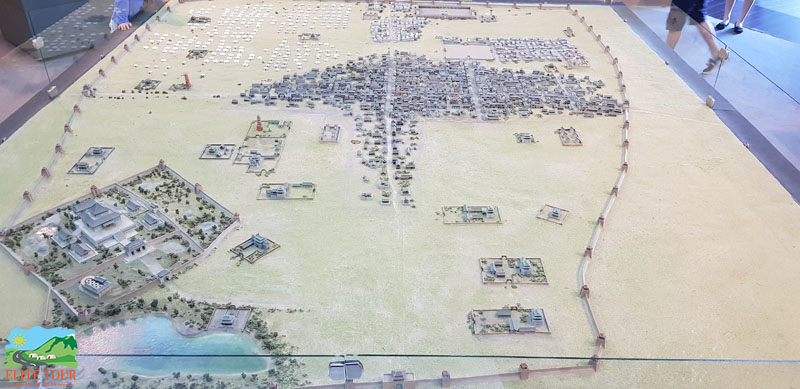
Karakorum
Tags
| end_date | 1388 |
|---|---|
| natural | water |
| source | https://cdn.greensoft.mn/uploads/users/715/images/20180712_144526.jpg |
| source:url | https://commons.wikimedia.org/wiki/File:Karakorum_Modell_2.jpg |
| start_date | 1220 |
Nodes
Welcome to OpenHistoricalMap!
OpenHistoricalMap is an interactive map of the world throughout history, created by people like you and dedicated to the public domain.
OpenHistoricalMap is a charter project of OpenStreetMap U.S., a 501(c)(3) nonprofit organization affiliated with the OpenStreetMap Foundation. Technical development is supported by GreenInfo Network and Development Seed.
| https://www.openhistoricalmap.org/copyright | https://www.openhistoricalmap.org |
| OpenHistoricalMap is dedicated to the public domain except where otherwise noted. | |