Loading...
Way: Mežnarija [1668 – ] (201129170)
Version #2
poznoantična naselbina pod Rogom nad Katarino pri Medvodah, Jeterbenk, Sv. Jakob na Petelincu, smleški Stari grad
- Edited by Janez Pavel Žebovec
- Changeset #185061
Tags
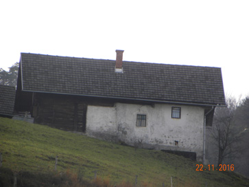
| building | yes |
|---|---|
| image | https://ised.gov.si/statika/KF_RNPD/kf_1_16340.jpg |
| name | Mežnarija |
| ref:eid | 1-16340 |
| start_date | 1668 |
| start_date:source | https://ipi.eprostor.gov.si/jv/ |
Nodes
Welcome to OpenHistoricalMap!
OpenHistoricalMap is an interactive map of the world throughout history, created by people like you and dedicated to the public domain.
OpenHistoricalMap is a charter project of OpenStreetMap U.S., a 501(c)(3) nonprofit organization affiliated with the OpenStreetMap Foundation. Technical development is supported by GreenInfo Network and Development Seed.
| https://www.openhistoricalmap.org/copyright | https://www.openhistoricalmap.org |
| OpenHistoricalMap is dedicated to the public domain except where otherwise noted. | |