Loading...
Way: Tates Creek Road [1969 – ] (201132227)
Version #1
Added 1970's Lexington, KY streets.
- Edited by Ben Colclough
- Changeset #179524
Tags
| highway | primary |
|---|---|
| name | Tates Creek Road |
| oneway | yes |
| source | Map of East Lexington |
| source:date | 1971 |
| source:name | USGS |
| source:url | https://ngmdb.usgs.gov/ht-bin/tv_browse.pl?id=d9f539766cc05137d3e4db5d8b1b3586 |
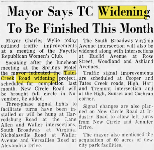
| start_date | 1969-09 |
| start_date:source | https://i.postimg.cc/MKGfYp68/tates-creek-widening.png |
Nodes
5 nodes
- 2135925455 (part of ways Tates Creek Road (KY 1972) [1969 – ] (201132214), [1969 – ] (201132226), and [1969 – ] (201127767))
- 2135894407
- 2135925433 (part of way [1969 – ] (201127765))
- 2135894408
- 2136020762 (part of ways Merrick Drive [1952 – 1971] (201132215), Merrick Drive [1952 – ] (201131942), Malabu Drive [1971 – ] (201132213), and Tates Creek Road [1969 – ] (201123613))
Welcome to OpenHistoricalMap!
OpenHistoricalMap is an interactive map of the world throughout history, created by people like you and dedicated to the public domain.
OpenHistoricalMap is a charter project of OpenStreetMap U.S., a 501(c)(3) nonprofit organization affiliated with the OpenStreetMap Foundation. Technical development is supported by GreenInfo Network and Development Seed.
| https://www.openhistoricalmap.org/copyright | https://www.openhistoricalmap.org |
| OpenHistoricalMap is dedicated to the public domain except where otherwise noted. | |