Loading...
Way: 201142591
Version #1
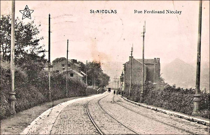
Saint-Nicolas, murs
Tags
| ! | used by multilinestring or multipolygon relations, please do not delete |
|---|---|
| geometry_class | railway |
| source:geometry | Claude Warzée - Histoire de la commune de Saint-Nicolas |
| source:geometry:link | https://i.goopics.net/ltxgx4.jpg |
Nodes
9 nodes
- 2136189038 (part of way 201142593)
- 2136189008
- 2136189007
- 2136189006
- 2136189005
- 2136189004
- 2136189003
- 2136189002
- 2136189001 (part of way 201142512)
Welcome to OpenHistoricalMap!
OpenHistoricalMap is an interactive map of the world throughout history, created by people like you and dedicated to the public domain.
OpenHistoricalMap is a charter project of OpenStreetMap U.S., a 501(c)(3) nonprofit organization affiliated with the OpenStreetMap Foundation. Technical development is supported by GreenInfo Network and Development Seed.
| https://www.openhistoricalmap.org/copyright | https://www.openhistoricalmap.org |
| OpenHistoricalMap is dedicated to the public domain except where otherwise noted. | |