Loading...
Way: 201180681
Version #1
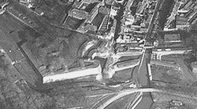
Maubeuge bastion des Jésuites
Tags
| ! | used by multilinestring or multipolygon relations, please do not delete |
|---|---|
| geometry_class | landuse |
| source:geometry | Photographie aérienne de 1915 https://villesetvillagesdelavesnois.org/rempartsmaubeuge/remparts-maubeuge-vue-aerienne-porte-des-poilus.jpg |
Nodes
2 nodes
- 2136754279 (part of ways 201180677, [1679 – 1900] (201180575), and [1679 – 1900] (201180682))
- 2136751710 (part of ways 201180680, [1679 – 1900] (201180683), and [1679 – 1948] (201180317))
Welcome to OpenHistoricalMap!
OpenHistoricalMap is an interactive map of the world throughout history, created by people like you and dedicated to the public domain.
OpenHistoricalMap is a charter project of OpenStreetMap U.S., a 501(c)(3) nonprofit organization affiliated with the OpenStreetMap Foundation. Technical development is supported by GreenInfo Network and Development Seed.
| https://www.openhistoricalmap.org/copyright | https://www.openhistoricalmap.org |
| OpenHistoricalMap is dedicated to the public domain except where otherwise noted. | |