Loading...
Way: [1679 – 1900] (201181022)
Version #2
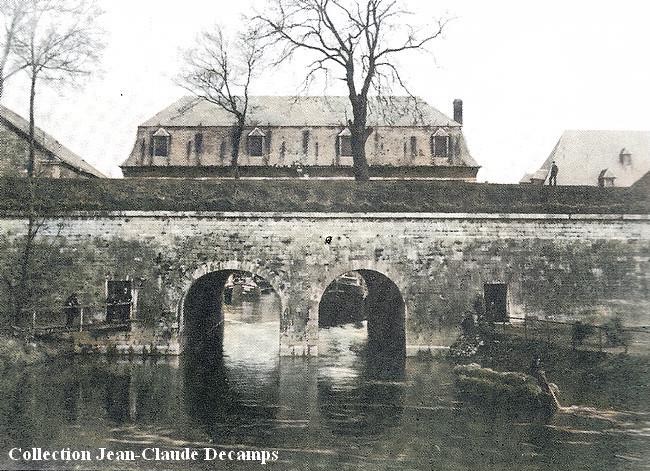
Maubeuge bastion des Jésuites
Tags
| bridge | yes |
|---|---|
| end_date | 1900-06-30 |
| end_date:source | https://villesetvillagesdelavesnois.org/rempartsmaubeuge/remparts-fortifications-vauban-maubeuge.html |
| highway | footway |
| layer | 1 |
| source:geometry | Photo prise en aval de la Sambre. https://villesetvillagesdelavesnois.org/rempartsmaubeuge/remparts-maubeuge-porte-sortie-des-eaux-1.jpg |
| start_date | 1679-07-01 |
| start_date:fixme | arbitrary |
Nodes
2 nodes
- 2136759564
- [1679 – 1900] (2136759477) (part of ways [1679 – 1900] (201181030) and [1679 – 1948] (201180696))
Welcome to OpenHistoricalMap!
OpenHistoricalMap is an interactive map of the world throughout history, created by people like you and dedicated to the public domain.
OpenHistoricalMap is a charter project of OpenStreetMap U.S., a 501(c)(3) nonprofit organization affiliated with the OpenStreetMap Foundation. Technical development is supported by GreenInfo Network and Development Seed.
| https://www.openhistoricalmap.org/copyright | https://www.openhistoricalmap.org |
| OpenHistoricalMap is dedicated to the public domain except where otherwise noted. | |