Relation History: Königreich Dalmatien [1815 – 1918] (2690520)
Version #26
Improve Bosnia and Herzegovina–Croatia border part 1
Tags
| admin_level | 4 |
|---|---|
| boundary | administrative |
| end_date | 1918-10-29 |
| end_event | State of Slovenes, Croats and Serbs secedes |
| fixme | confirm border definition of islands between Istria and Dalmatia |
| fixme:e | needs start_event, end_event, or both |
| fixme:place | need to figure out what places these are... |
| name | Königreich Dalmatien |
| name:en | Kingdom of Dalmatia |
| place | state |
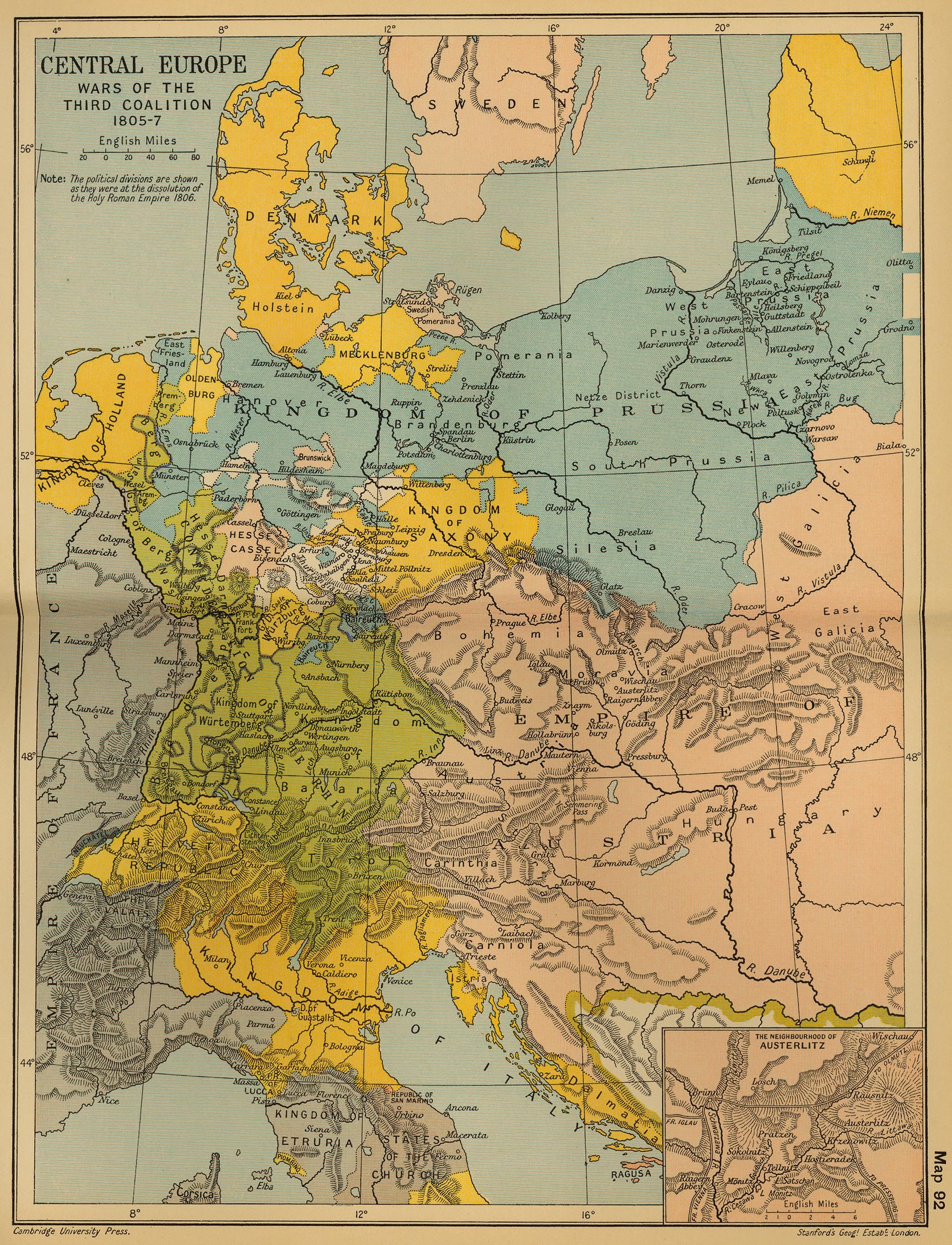
| source | https://maps.lib.utexas.edu/maps/historical/ward_1912/europe_central_1805.jpg |
| source:name | Central Europe: Wars of the Third Coalition 1805-7'; from 'Cambridge Modern History Atlas', 1912 |
| start_date | 1815-06-09 |
| type | boundary |
| wikidata | Q698248 |
| wikipedia | en:Kingdom of Dalmatia |
Members
51 members
- Relation Kreis Cattaro [1822 – 1868] (2829039) as subarea
- Relation Kreis Ragusa [1822 – 1868] (2829038) as subarea
- Node Dalmatien [1815 – 1918] (2104060595) as label
- Way Svetac 3NM offshore line for empires and large area relations (200910001) as outer
- Way 3NM offshore line for empires and large area relations (200916771) as outer
- Way 3.2NM offshore line for empires and large area relations (200931329) as outer
- Way 3NM offshore line for empires and large area relations (200931331) as outer
- Way 3.2NM offshore line for empires and large area relations (200916770) as outer
- Way cartographic bridge (200916765) as outer
- Way cartographic bridge (200916768) as outer
- Way cartographic bridge (200916766) as outer
- Way 3.2NM offshore line for empires and large area relations (200916767) as outer
- Way 200913445 as outer
- Way 3NM offshore line for empires and large area relations (200931320) as outer
- Way 3NM offshore line for empires and large area relations (200931317) as outer
- Way 3NM offshore line for empires and large area relations (200931314) as outer
- Way 3NM offshore line for empires and large area relations (200910386) as outer
- Way cartographic adjustment (200916777) as outer
- Way cartographic bridge (200916778) as outer
- Way cartographic adjustment (200916776) as outer
- Way 3NM offshore line for empires and large area relations (200915667) as outer
- Way 3NM offshore line for empires and large area relations (200916772) as outer
- Way cartographic adjustment (200916773) as outer
- Way cartographic bridge (200916775) as outer
- Way cartographic adjustment (200916774) as outer
- Way 3NM offshore line for empires and large area relations (200915668) as outer
- Way 3NM offshore line for empires and large area relations (200915666) as outer
- Way 3NM offshore line for empires and large area relations (200931652) as outer
- Way 3NM offshore line for empires and large area relations (200915848) as outer
- Way 199612925 as outer
- Way 199612931 as outer
- Way 198693441 as outer
- Way 198567161 as outer
- Way 199612932 as outer
- Way 198567163 as outer
- Way 200813485 as outer
- Way 198567373 as outer
- Way 198557013 as outer
- Way 200944729 as outer
- Way 200944728 as outer
- Way 200176629 as outer
- Way 198532410 as outer
- Way 198567175 as outer
- Way 198750298 as outer
- Way 199600482 as outer
- Way Vis 3NM offshore line for empires and large area relations (200910002) as outer
- Way Sušac 3NM offshore line for empires and large area relations (200910003) as outer
- Way Lastovo 3NM offshore line for empires and large area relations (200910005) as outer
- Way 200547085 as outer
- Way 200917057 as outer
- Way 200495800 as outer
Version #25
cleaning up Italian peninsula admin_level<3 relations as part of moving to maritime boundaries; adding fixme tags & source requests
Tags
| admin_level | 4 |
|---|---|
| boundary | administrative |
| end_date | 1918-10-29 |
| end_event | State of Slovenes, Croats and Serbs secedes |
| fixme | confirm border definition of islands between Istria and Dalmatia |
| fixme:e | needs start_event, end_event, or both |
| fixme:place | need to figure out what places these are... |
| name | Königreich Dalmatien |
| name:en | Kingdom of Dalmatia |
| place | state |
| source | https://maps.lib.utexas.edu/maps/historical/ward_1912/europe_central_1805.jpg |
| source:name | Central Europe: Wars of the Third Coalition 1805-7'; from 'Cambridge Modern History Atlas', 1912 |
| start_date | 1815-06-09 |
| type | boundary |
| wikidata | Q698248 |
| wikipedia | en:Kingdom of Dalmatia |
Members
49 members
- Relation Kreis Cattaro [1822 – 1868] (2829039) as subarea
- Relation Kreis Ragusa [1822 – 1868] (2829038) as subarea
- Node Dalmatien [1815 – 1918] (2104060595) as label
- Way Svetac 3NM offshore line for empires and large area relations (200910001) as outer
- Way 3NM offshore line for empires and large area relations (200916771) as outer
- Way 3.2NM offshore line for empires and large area relations (200931329) as outer
- Way 3NM offshore line for empires and large area relations (200931331) as outer
- Way 3.2NM offshore line for empires and large area relations (200916770) as outer
- Way cartographic bridge (200916765) as outer
- Way cartographic bridge (200916768) as outer
- Way cartographic bridge (200916766) as outer
- Way 3.2NM offshore line for empires and large area relations (200916767) as outer
- Way 200913445 as outer
- Way 3NM offshore line for empires and large area relations (200931320) as outer
- Way 3NM offshore line for empires and large area relations (200931317) as outer
- Way 3NM offshore line for empires and large area relations (200931314) as outer
- Way 3NM offshore line for empires and large area relations (200910386) as outer
- Way cartographic adjustment (200916777) as outer
- Way cartographic bridge (200916778) as outer
- Way cartographic adjustment (200916776) as outer
- Way 3NM offshore line for empires and large area relations (200915667) as outer
- Way 3NM offshore line for empires and large area relations (200916772) as outer
- Way cartographic adjustment (200916773) as outer
- Way cartographic bridge (200916775) as outer
- Way cartographic adjustment (200916774) as outer
- Way 3NM offshore line for empires and large area relations (200915668) as outer
- Way 3NM offshore line for empires and large area relations (200915666) as outer
- Way 3NM offshore line for empires and large area relations (200931652) as outer
- Way 3NM offshore line for empires and large area relations (200915848) as outer
- Way 199612925 as outer
- Way 199612931 as outer
- Way 198693441 as outer
- Way 198567161 as outer
- Way 199612932 as outer
- Way 198567163 as outer
- Way 200813485 as outer
- Way 198567373 as outer
- Way 198557013 as outer
- Way 200176629 as outer
- Way 198532410 as outer
- Way 198567175 as outer
- Way 198750298 as outer
- Way 199600482 as outer
- Way Vis 3NM offshore line for empires and large area relations (200910002) as outer
- Way Sušac 3NM offshore line for empires and large area relations (200910003) as outer
- Way Lastovo 3NM offshore line for empires and large area relations (200910005) as outer
- Way 200547085 as outer
- Way 200917057 as outer
- Way 200495800 as outer
Version #24
tagging a bunch of relations with needs for... additional tagging!
Tags
| admin_level | 4 |
|---|---|
| boundary | administrative |
| end_date | 1918-10-29 |
| end_event | State of Slovenes, Croats and Serbs secedes |
| fixme | confirm border definition of islands between Istria and Dalmatia |
| fixme:e | needs start_event, end_event, or both |
| fixme:place | need to figure out what places these are... |
| name | Königreich Dalmatien |
| name:en | Kingdom of Dalmatia |
| place | state |
| source | https://maps.lib.utexas.edu/maps/historical/ward_1912/europe_central_1805.jpg |
| source:name | Central Europe: Wars of the Third Coalition 1805-7'; from 'Cambridge Modern History Atlas', 1912 |
| start_date | 1815-06-09 |
| type | boundary |
| wikidata | Q698248 |
| wikipedia | en:Kingdom of Dalmatia |
Members
50 members
- Relation Kreis Cattaro [1822 – 1868] (2829039) as subarea
- Relation Kreis Ragusa [1822 – 1868] (2829038) as subarea
- Node Dalmatien [1815 – 1918] (2104060595) as label
- Way Svetac 3NM offshore line for empires and large area relations (200910001) as outer
- Way 3NM offshore line for empires and large area relations (200916771) as outer
- Way 3.2NM offshore line for empires and large area relations (200931329) as outer
- Way 3NM offshore line for empires and large area relations (200931331) as outer
- Way 3.2NM offshore line for empires and large area relations (200916770) as outer
- Way cartographic bridge (200916765) as outer
- Way cartographic bridge (200916768) as outer
- Way cartographic bridge (200916766) as outer
- Way 3.2NM offshore line for empires and large area relations (200916767) as outer
- Way 200913445 as outer
- Way 3NM offshore line for empires and large area relations (200931320) as outer
- Way 3NM offshore line for empires and large area relations (200931317) as outer
- Way 3NM offshore line for empires and large area relations (200931314) as outer
- Way 3NM offshore line for empires and large area relations (200910386) as outer
- Way cartographic adjustment (200916777) as outer
- Way cartographic bridge (200916778) as outer
- Way cartographic adjustment (200916776) as outer
- Way 3NM offshore line for empires and large area relations (200915667) as outer
- Way 3NM offshore line for empires and large area relations (200916772) as outer
- Way cartographic adjustment (200916773) as outer
- Way cartographic bridge (200916775) as outer
- Way cartographic adjustment (200916774) as outer
- Way 3NM offshore line for empires and large area relations (200915668) as outer
- Way 3NM offshore line for empires and large area relations (200915666) as outer
- Way 3NM offshore line for empires and large area relations (200931652) as outer
Way 200916782 as outer- Way 3NM offshore line for empires and large area relations (200915848) as outer
- Way 199612925 as outer
- Way 199612931 as outer
- Way 198693441 as outer
- Way 198567161 as outer
- Way 199612932 as outer
- Way 198567163 as outer
- Way 200813485 as outer
- Way 198567373 as outer
- Way 198557013 as outer
- Way 200176629 as outer
- Way 198532410 as outer
- Way 198567175 as outer
- Way 198750298 as outer
- Way 199600482 as outer
- Way Vis 3NM offshore line for empires and large area relations (200910002) as outer
- Way Sušac 3NM offshore line for empires and large area relations (200910003) as outer
- Way Lastovo 3NM offshore line for empires and large area relations (200910005) as outer
- Way 200547085 as outer
- Way 200917057 as outer
- Way 200495800 as outer
Version #23
lots more Eastern Adriatic cleanup, moving boundaries off shore (again?)
Tags
| admin_level | 4 |
|---|---|
| boundary | administrative |
| end_date | 1918-10-29 |
| end_event | State of Slovenes, Croats and Serbs secedes |
| fixme | confirm border definition of islands between Istria and Dalmatia |
| fixme:place | need to figure out what places these are... |
| name | Königreich Dalmatien |
| name:en | Kingdom of Dalmatia |
| place | state |
| source | https://maps.lib.utexas.edu/maps/historical/ward_1912/europe_central_1805.jpg |
| source:name | Central Europe: Wars of the Third Coalition 1805-7'; from 'Cambridge Modern History Atlas', 1912 |
| start_date | 1815-06-09 |
| type | boundary |
| wikidata | Q698248 |
| wikipedia | en:Kingdom of Dalmatia |
Members
50 members
- Relation Kreis Cattaro [1822 – 1868] (2829039) as subarea
- Relation Kreis Ragusa [1822 – 1868] (2829038) as subarea
- Node Dalmatien [1815 – 1918] (2104060595) as label
- Way Svetac 3NM offshore line for empires and large area relations (200910001) as outer
- Way 3NM offshore line for empires and large area relations (200916771) as outer
- Way 3.2NM offshore line for empires and large area relations (200931329) as outer
- Way 3NM offshore line for empires and large area relations (200931331) as outer
- Way 3.2NM offshore line for empires and large area relations (200916770) as outer
- Way cartographic bridge (200916765) as outer
- Way cartographic bridge (200916768) as outer
- Way cartographic bridge (200916766) as outer
- Way 3.2NM offshore line for empires and large area relations (200916767) as outer
- Way 200913445 as outer
- Way 3NM offshore line for empires and large area relations (200931320) as outer
- Way 3NM offshore line for empires and large area relations (200931317) as outer
- Way 3NM offshore line for empires and large area relations (200931314) as outer
- Way 3NM offshore line for empires and large area relations (200910386) as outer
- Way cartographic adjustment (200916777) as outer
- Way cartographic bridge (200916778) as outer
- Way cartographic adjustment (200916776) as outer
- Way 3NM offshore line for empires and large area relations (200915667) as outer
- Way 3NM offshore line for empires and large area relations (200916772) as outer
- Way cartographic adjustment (200916773) as outer
- Way cartographic bridge (200916775) as outer
- Way cartographic adjustment (200916774) as outer
- Way 3NM offshore line for empires and large area relations (200915668) as outer
- Way 3NM offshore line for empires and large area relations (200915666) as outer
- Way 3NM offshore line for empires and large area relations (200931652) as outer
Way 200916782 as outer- Way 3NM offshore line for empires and large area relations (200915848) as outer
- Way 199612925 as outer
- Way 199612931 as outer
- Way 198693441 as outer
- Way 198567161 as outer
- Way 199612932 as outer
- Way 198567163 as outer
- Way 200813485 as outer
- Way 198567373 as outer
- Way 198557013 as outer
- Way 200176629 as outer
- Way 198532410 as outer
- Way 198567175 as outer
- Way 198750298 as outer
- Way 199600482 as outer
- Way Vis 3NM offshore line for empires and large area relations (200910002) as outer
- Way Sušac 3NM offshore line for empires and large area relations (200910003) as outer
- Way Lastovo 3NM offshore line for empires and large area relations (200910005) as outer
- Way 200547085 as outer
- Way 200917057 as outer
- Way 200495800 as outer
Version #22
lots of Eastern Adriatic cleanup, moving boundaries off shore (again?)
Tags
| admin_level | 4 |
|---|---|
| boundary | administrative |
| end_date | 1918-10-29 |
| end_event | State of Slovenes, Croats and Serbs secedes |
| fixme | confirm border definition of islands between Istria and Dalmatia |
| fixme:place | need to figure out what places these are... |
| name | Königreich Dalmatien |
| name:en | Kingdom of Dalmatia |
| place | state |
| source | https://maps.lib.utexas.edu/maps/historical/ward_1912/europe_central_1805.jpg |
| source:name | Central Europe: Wars of the Third Coalition 1805-7'; from 'Cambridge Modern History Atlas', 1912 |
| start_date | 1815-06-09 |
| type | boundary |
| wikidata | Q698248 |
| wikipedia | en:Kingdom of Dalmatia |
Members
49 members
- Relation Kreis Cattaro [1822 – 1868] (2829039) as subarea
- Relation Kreis Ragusa [1822 – 1868] (2829038) as subarea
- Node Dalmatien [1815 – 1918] (2104060595) as label
- Way Svetac 3NM offshore line for empires and large area relations (200910001) as outer
- Way 3NM offshore line for empires and large area relations (200916771) as outer
- Way 3.2NM offshore line for empires and large area relations (200931329) as outer
- Way 3NM offshore line for empires and large area relations (200931331) as outer
- Way 3.2NM offshore line for empires and large area relations (200916770) as outer
- Way cartographic bridge (200916765) as outer
- Way cartographic bridge (200916768) as outer
- Way cartographic bridge (200916766) as outer
- Way 3.2NM offshore line for empires and large area relations (200916767) as outer
- Way 200913445 as outer
- Way 3NM offshore line for empires and large area relations (200931320) as outer
- Way 3NM offshore line for empires and large area relations (200931317) as outer
- Way 3NM offshore line for empires and large area relations (200931314) as outer
- Way 3NM offshore line for empires and large area relations (200910386) as outer
- Way cartographic adjustment (200916777) as outer
- Way cartographic bridge (200916778) as outer
- Way cartographic adjustment (200916776) as outer
- Way 3NM offshore line for empires and large area relations (200915667) as outer
- Way 3NM offshore line for empires and large area relations (200916772) as outer
- Way cartographic adjustment (200916773) as outer
- Way cartographic bridge (200916775) as outer
- Way cartographic adjustment (200916774) as outer
- Way 3NM offshore line for empires and large area relations (200915668) as outer
- Way 3NM offshore line for empires and large area relations (200915666) as outer
Way 200916782 as outer- Way 3NM offshore line for empires and large area relations (200915848) as outer
- Way 199612925 as outer
- Way 199612931 as outer
- Way 198693441 as outer
- Way 198567161 as outer
- Way 199612932 as outer
- Way 198567163 as outer
- Way 200813485 as outer
- Way 198567373 as outer
- Way 198557013 as outer
- Way 200176629 as outer
- Way 198532410 as outer
- Way 198567175 as outer
- Way 198750298 as outer
- Way 199600482 as outer
- Way Vis 3NM offshore line for empires and large area relations (200910002) as outer
- Way Sušac 3NM offshore line for empires and large area relations (200910003) as outer
- Way Lastovo 3NM offshore line for empires and large area relations (200910005) as outer
- Way 200547085 as outer
- Way 200917057 as outer
- Way 200495800 as outer
Version #21
Clean up (Dalmatia and Croatia-Slavonia border)
Tags
| admin_level | 4 |
|---|---|
| boundary | administrative |
| end_date | 1918-10-29 |
| end_event | State of Slovenes, Croats and Serbs secedes |
| fixme | confirm border definition of islands between Istria and Dalmatia |
| fixme:place | need to figure out what places these are... |
| name | Königreich Dalmatien |
| name:en | Kingdom of Dalmatia |
| place | state |
| source | https://maps.lib.utexas.edu/maps/historical/ward_1912/europe_central_1805.jpg |
| source:name | Central Europe: Wars of the Third Coalition 1805-7'; from 'Cambridge Modern History Atlas', 1912 |
| start_date | 1815-06-09 |
| type | boundary |
| wikidata | Q698248 |
| wikipedia | en:Kingdom of Dalmatia |
Members
41 members
- Relation Kreis Cattaro [1822 – 1868] (2829039) as subarea
- Relation Kreis Ragusa [1822 – 1868] (2829038) as subarea
- Node Dalmatien [1815 – 1918] (2104060595) as label
- Way Svetac 3NM offshore line for empires and large area relations (200910001) as outer
- Way 3NM offshore line for empires and large area relations (200916771) as outer
- Way 3.2NM offshore line for empires and large area relations (200916770) as outer
- Way cartographic bridge (200916765) as outer
- Way cartographic bridge (200916768) as outer
- Way cartographic bridge (200916766) as outer
- Way 3.2NM offshore line for empires and large area relations (200916767) as outer
- Way 200913445 as outer
- Way 3NM offshore line for empires and large area relations (200910386) as outer
- Way cartographic adjustment (200916777) as outer
- Way cartographic bridge (200916778) as outer
- Way cartographic adjustment (200916776) as outer
- Way 3NM offshore line for empires and large area relations (200915667) as outer
- Way 3NM offshore line for empires and large area relations (200916772) as outer
- Way cartographic adjustment (200916773) as outer
- Way cartographic bridge (200916775) as outer
- Way cartographic adjustment (200916774) as outer
- Way 3NM offshore line for empires and large area relations (200915668) as outer
- Way 3NM offshore line for empires and large area relations (200915666) as outer
Way 200916782 as outer- Way 3NM offshore line for empires and large area relations (200915848) as outer
- Way 199612925 as outer
- Way 199612931 as outer
- Way 198693441 as outer
- Way 198567161 as outer
- Way 199612932 as outer
- Way 198567163 as outer
- Way 200813485 as outer
- Way 198567373 as outer
- Way 198557013 as outer
- Way 200176629 as outer
- Way 198532410 as outer
- Way 198567175 as outer
- Way 198750298 as outer
- Way 199600482 as outer
- Way Vis 3NM offshore line for empires and large area relations (200910002) as outer
- Way Sušac 3NM offshore line for empires and large area relations (200910003) as outer
- Way Lastovo 3NM offshore line for empires and large area relations (200910005) as outer
Version #20
1 Holy Roman Empire relation updates; moving some Italian-peninsula and vicinity admin boundaries offshore
Tags
| admin_level | 4 |
|---|---|
| boundary | administrative |
| end_date | 1918-10-29 |
| end_event | State of Slovenes, Croats and Serbs secedes |
| fixme | confirm border definition of islands between Istria and Dalmatia |
| fixme:place | need to figure out what places these are... |
| name | Königreich Dalmatien |
| name:en | Kingdom of Dalmatia |
| place | state |
| source | https://maps.lib.utexas.edu/maps/historical/ward_1912/europe_central_1805.jpg |
| source:name | Central Europe: Wars of the Third Coalition 1805-7'; from 'Cambridge Modern History Atlas', 1912 |
| start_date | 1815-06-09 |
| type | boundary |
| wikidata | Q698248 |
| wikipedia | en:Kingdom of Dalmatia |
Members
41 members
- Relation Kreis Cattaro [1822 – 1868] (2829039) as subarea
- Relation Kreis Ragusa [1822 – 1868] (2829038) as subarea
- Node Dalmatien [1815 – 1918] (2104060595) as label
- Way Svetac 3NM offshore line for empires and large area relations (200910001) as outer
- Way 3NM offshore line for empires and large area relations (200916771) as outer
- Way 3.2NM offshore line for empires and large area relations (200916770) as outer
- Way cartographic bridge (200916765) as outer
- Way cartographic bridge (200916768) as outer
- Way cartographic bridge (200916766) as outer
- Way 3.2NM offshore line for empires and large area relations (200916767) as outer
- Way 200913445 as outer
- Way 3NM offshore line for empires and large area relations (200910386) as outer
- Way cartographic adjustment (200916777) as outer
- Way cartographic bridge (200916778) as outer
- Way cartographic adjustment (200916776) as outer
- Way 3NM offshore line for empires and large area relations (200915667) as outer
- Way 3NM offshore line for empires and large area relations (200916772) as outer
- Way cartographic adjustment (200916773) as outer
- Way cartographic bridge (200916775) as outer
- Way cartographic adjustment (200916774) as outer
- Way 3NM offshore line for empires and large area relations (200915668) as outer
- Way 3NM offshore line for empires and large area relations (200915666) as outer
Way 200916782 as outer- Way 3NM offshore line for empires and large area relations (200915848) as outer
- Way 199612925 as outer
- Way 199612931 as outer
- Way 198693441 as outer
- Way 198567161 as outer
- Way 199612932 as outer
- Way 198567163 as outer
- Way 200813485 as outer
- Way 198567373 as outer
- Way 198557013 as outer
- Way 200176629 as outer
- Way 198532410 as outer
Way 200915676 as outer- Way 198750298 as outer
- Way 199600482 as outer
- Way Vis 3NM offshore line for empires and large area relations (200910002) as outer
- Way Sušac 3NM offshore line for empires and large area relations (200910003) as outer
- Way Lastovo 3NM offshore line for empires and large area relations (200910005) as outer
Version #19
tag changes/standardization: start_date:cause -> start_event; end_date:cause -> end_event; wikipeda -> wikipedia
Tags
| admin_level | 4 |
|---|---|
| boundary | administrative |
| end_date | 1918-10-29 |
| end_event | State of Slovenes, Croats and Serbs secedes |
| fixme | confirm border definition of islands between Istria and Dalmatia |
| fixme:place | need to figure out what places these are... |
| name | Königreich Dalmatien |
| name:en | Kingdom of Dalmatia |
| place | state |
| source | https://maps.lib.utexas.edu/maps/historical/ward_1912/europe_central_1805.jpg |
| source:name | Central Europe: Wars of the Third Coalition 1805-7'; from 'Cambridge Modern History Atlas', 1912 |
| start_date | 1815-06-09 |
| type | boundary |
| wikidata | Q698248 |
| wikipedia | en:Kingdom of Dalmatia |
Members
41 members
- Relation Kreis Cattaro [1822 – 1868] (2829039) as subarea
- Relation Kreis Ragusa [1822 – 1868] (2829038) as subarea
- Node Dalmatien [1815 – 1918] (2104060595) as label
- Way Svetac 3NM offshore line for empires and large area relations (200910001) as outer
- Way 3NM offshore line for empires and large area relations (200916771) as outer
- Way 3.2NM offshore line for empires and large area relations (200916770) as outer
- Way cartographic bridge (200916765) as outer
- Way cartographic bridge (200916768) as outer
- Way cartographic bridge (200916766) as outer
- Way 3.2NM offshore line for empires and large area relations (200916767) as outer
- Way 200913445 as outer
- Way 3NM offshore line for empires and large area relations (200910386) as outer
- Way cartographic adjustment (200916777) as outer
- Way cartographic bridge (200916778) as outer
- Way cartographic adjustment (200916776) as outer
- Way 3NM offshore line for empires and large area relations (200915667) as outer
- Way 3NM offshore line for empires and large area relations (200916772) as outer
- Way cartographic adjustment (200916773) as outer
- Way cartographic bridge (200916775) as outer
- Way cartographic adjustment (200916774) as outer
- Way 3NM offshore line for empires and large area relations (200915668) as outer
- Way 3NM offshore line for empires and large area relations (200915666) as outer
Way 200916782 as outer- Way 3NM offshore line for empires and large area relations (200915848) as outer
- Way 199612925 as outer
- Way 199612931 as outer
- Way 198693441 as outer
- Way 198567161 as outer
- Way 199612932 as outer
- Way 198567163 as outer
- Way 200813485 as outer
- Way 198567373 as outer
- Way 198557013 as outer
- Way 200176629 as outer
- Way 198532410 as outer
Way 200915676 as outer- Way 198750298 as outer
- Way 199600482 as outer
- Way Vis 3NM offshore line for empires and large area relations (200910002) as outer
- Way Sušac 3NM offshore line for empires and large area relations (200910003) as outer
- Way Lastovo 3NM offshore line for empires and large area relations (200910005) as outer
Version #18
Cleaning up 2 Dalmatians, 99 to go; Moving some Italian-peninsula admin boundaries offshore; adding some sources & wiki tags
Tags
| admin_level | 4 |
|---|---|
| boundary | administrative |
| end_date | 1918-10-29 |
| end_date:cause | State of Slovenes, Croats and Serbs secedes |
| fixme | confirm border definition of islands between Istria and Dalmatia |
| fixme:place | need to figure out what places these are... |
| name | Königreich Dalmatien |
| name:en | Kingdom of Dalmatia |
| place | state |
| source | https://maps.lib.utexas.edu/maps/historical/ward_1912/europe_central_1805.jpg |
| source:name | Central Europe: Wars of the Third Coalition 1805-7'; from 'Cambridge Modern History Atlas', 1912 |
| start_date | 1815-06-09 |
| type | boundary |
| wikidata | Q698248 |
| wikipedia | en:Kingdom of Dalmatia |
Members
41 members
- Relation Kreis Cattaro [1822 – 1868] (2829039) as subarea
- Relation Kreis Ragusa [1822 – 1868] (2829038) as subarea
- Node Dalmatien [1815 – 1918] (2104060595) as label
- Way Svetac 3NM offshore line for empires and large area relations (200910001) as outer
- Way 3NM offshore line for empires and large area relations (200916771) as outer
- Way 3.2NM offshore line for empires and large area relations (200916770) as outer
- Way cartographic bridge (200916765) as outer
- Way cartographic bridge (200916768) as outer
- Way cartographic bridge (200916766) as outer
- Way 3.2NM offshore line for empires and large area relations (200916767) as outer
- Way 200913445 as outer
- Way 3NM offshore line for empires and large area relations (200910386) as outer
- Way cartographic adjustment (200916777) as outer
- Way cartographic bridge (200916778) as outer
- Way cartographic adjustment (200916776) as outer
- Way 3NM offshore line for empires and large area relations (200915667) as outer
- Way 3NM offshore line for empires and large area relations (200916772) as outer
- Way cartographic adjustment (200916773) as outer
- Way cartographic bridge (200916775) as outer
- Way cartographic adjustment (200916774) as outer
- Way 3NM offshore line for empires and large area relations (200915668) as outer
- Way 3NM offshore line for empires and large area relations (200915666) as outer
Way 200916782 as outer- Way 3NM offshore line for empires and large area relations (200915848) as outer
- Way 199612925 as outer
- Way 199612931 as outer
- Way 198693441 as outer
- Way 198567161 as outer
- Way 199612932 as outer
- Way 198567163 as outer
- Way 200813485 as outer
- Way 198567373 as outer
- Way 198557013 as outer
- Way 200176629 as outer
- Way 198532410 as outer
Way 200915676 as outer- Way 198750298 as outer
- Way 199600482 as outer
- Way Vis 3NM offshore line for empires and large area relations (200910002) as outer
- Way Sušac 3NM offshore line for empires and large area relations (200910003) as outer
- Way Lastovo 3NM offshore line for empires and large area relations (200910005) as outer
Version #17
Improve Coratia-Montenegro border
Tags
| admin_level | 4 |
|---|---|
| boundary | administrative |
| end_date | 1918-10-29 |
| end_date:cause | State of Slovenes, Croats and Serbs secedes |
| fixme:place | need to figure out what places these are... |
| name | Königreich Dalmatien |
| name:en | Kingdom of Dalmatia |
| place | state |
| start_date | 1815-06-09 |
| type | boundary |
| wikidata | Q698248 |
Members
22 members
- Node Dalmatien [1815 – 1918] (2104060595) as label
Way 198750299 as outer- Way 199600482 as outer
- Way 198750298 as outer
- Way 198532410 as outer
- Way 200176629 as outer
- Way 198557013 as outer
- Way 200813485 as outer
- Way 198567373 as outer
- Way 198567163 as outer
- Way 199612932 as outer
- Way 198567161 as outer
- Way 198693441 as outer
- Way 199612931 as outer
- Way 199612925 as outer
- Way 198567365 as outer
Way 198567358 as outer- Way 198567368 as outer
Way 198579263 as outer- Way 198567370 as outer
- Relation Kreis Ragusa [1822 – 1868] (2829038) as subarea
- Relation Kreis Cattaro [1822 – 1868] (2829039) as subarea
Version #16
Added pre-1920 Vas county
Tags
| admin_level | 4 |
|---|---|
| boundary | administrative |
| end_date | 1918-10-29 |
| end_date:cause | State of Slovenes, Croats and Serbs secedes |
| fixme:place | need to figure out what places these are... |
| name | Königreich Dalmatien |
| name:en | Kingdom of Dalmatia |
| place | state |
| start_date | 1815-06-09 |
| type | boundary |
| wikidata | Q698248 |
Members
21 members
- Node Dalmatien [1815 – 1918] (2104060595) as label
Way 198750299 as outer- Way 199600482 as outer
- Way 198750298 as outer
- Way 198532410 as outer
- Way 200176629 as outer
- Way 198557013 as outer
- Way 198567373 as outer
- Way 198567163 as outer
- Way 199612932 as outer
- Way 198567161 as outer
- Way 198693441 as outer
- Way 199612931 as outer
- Way 199612925 as outer
- Way 198567365 as outer
Way 198567358 as outer- Way 198567368 as outer
Way 198579263 as outer- Way 198567370 as outer
- Relation Kreis Ragusa [1822 – 1868] (2829038) as subarea
- Relation Kreis Cattaro [1822 – 1868] (2829039) as subarea
Version #15
Added Duchy of Milan 1786-91 (while Mantua was integrated); Fixed Venice relations and added Dalmatia; Very roughly corrected Venetian-Papal border
Tags
| admin_level | 4 |
|---|---|
| boundary | administrative |
| end_date | 1918-10-29 |
| end_date:cause | State of Slovenes, Croats and Serbs secedes |
| fixme:place | need to figure out what places these are... |
| name | Königreich Dalmatien |
| name:en | Kingdom of Dalmatia |
| place | state |
| start_date | 1815-06-09 |
| type | boundary |
| wikidata | Q698248 |
Members
19 members
- Node Dalmatien [1815 – 1918] (2104060595) as label
Way 198750299 as outer- Way 199600482 as outer
- Way 198750298 as outer
- Way 198532410 as outer
- Way 200176629 as outer
- Way 198557013 as outer
- Way 198567373 as outer
- Way 198567163 as outer
- Way 199612932 as outer
- Way 198567161 as outer
- Way 198693441 as outer
- Way 199612931 as outer
- Way 199612925 as outer
- Way 198567365 as outer
Way 198567358 as outer- Way 198567368 as outer
Way 198579263 as outer- Way 198567370 as outer
Version #14
Added Trans/Cisleithania 1902-18 (earlier attempts failed to upload); Added Carniola to Cisleithania; Added Trans/Cisleithania as subareas to Austria-Hungary; adjusted some crownland admin_levels for proper hierarchy within Austria-Hungary
Tags
| admin_level | 4 |
|---|---|
| boundary | administrative |
| end_date | 1918-10-29 |
| end_date:cause | State of Slovenes, Croats and Serbs secedes |
| fixme:place | need to figure out what places these are... |
| name | Königreich Dalmatien |
| name:en | Kingdom of Dalmatia |
| place | state |
| start_date | 1815-06-09 |
| type | boundary |
| wikidata | Q698248 |
Members
18 members
- Node Dalmatien [1815 – 1918] (2104060595) as label
Way 198750299 as outer- Way 199600482 as outer
- Way 198750298 as outer
- Way 198532410 as outer
- Way 198557013 as outer
- Way 198567373 as outer
- Way 198567163 as outer
- Way 199612932 as outer
- Way 198567161 as outer
- Way 198693441 as outer
- Way 199612931 as outer
- Way 199612925 as outer
- Way 198567365 as outer
Way 198567358 as outer- Way 198567368 as outer
Way 198579263 as outer- Way 198567370 as outer
Version #13
Fixes to the Ottoman subdivisions surrounding Montenegro and Kotor/Cattaro
Tags
| admin_level | 3 |
|---|---|
| boundary | administrative |
| end_date | 1918-10-29 |
| end_date:cause | State of Slovenes, Croats and Serbs secedes |
| fixme:place | need to figure out what places these are... |
| name | Königreich Dalmatien |
| name:en | Kingdom of Dalmatia |
| place | state |
| start_date | 1815 |
| type | boundary |
| wikidata | Q698248 |
Members
18 members
- Node Dalmatien [1815 – 1918] (2104060595) as label
Way 198750299 as outer- Way 199600482 as outer
- Way 198750298 as outer
- Way 198532410 as outer
- Way 198557013 as outer
- Way 198567373 as outer
- Way 198567163 as outer
- Way 199612932 as outer
- Way 198567161 as outer
- Way 198693441 as outer
- Way 199612931 as outer
- Way 199612925 as outer
- Way 198567365 as outer
Way 198567358 as outer- Way 198567368 as outer
Way 198579263 as outer- Way 198567370 as outer
Version #12
Added counties of Zagreb (1809-22; 1860-71) and Varasdin (1102-1854; 1860-71), as well as basic versions of the Slavonian counties 1854-60. Amended the border of Međimurje 1854-60. Added labels for several subdivisions of the Illyrian Provinces.
Tags
| admin_level | 3 |
|---|---|
| boundary | administrative |
| end_date | 1918-10-29 |
| end_date:cause | State of Slovenes, Croats and Serbs secedes |
| fixme:place | need to figure out what places these are... |
| name | Königreich Dalmatien |
| name:en | Kingdom of Dalmatia |
| place | state |
| start_date | 1815 |
| type | boundary |
| wikidata | Q698248 |
Members
15 members
- Node Dalmatien [1815 – 1918] (2104060595) as label
Way 198750299 as outer- Way 199600482 as outer
- Way 198750298 as outer
- Way 198532410 as outer
- Way 198557013 as outer
- Way 198567373 as outer
- Way 198567163 as outer
- Way 198567161 as outer
- Way 198693441 as outer
- Way 198567365 as outer
Way 198567358 as outer- Way 198567368 as outer
Way 198579263 as outer- Way 198567370 as outer
Version #11
Various improvements and corrections to Croatia/Slavonia/Military Frontier and Illyria, including better borders (most are still quite basic), some subdivisions and more accurate dates and extents.
Tags
| admin_level | 3 |
|---|---|
| boundary | administrative |
| end_date | 1918-10-29 |
| end_date:cause | State of Slovenes, Croats and Serbs secedes |
| fixme:place | need to figure out what places these are... |
| name | Königreich Dalmatien |
| name:en | Kingdom of Dalmatia |
| place | state |
| start_date | 1815 |
| type | boundary |
| wikidata | Q698248 |
Members
14 members
Way 198750299 as outer- Way 199600482 as outer
- Way 198750298 as outer
- Way 198532410 as outer
- Way 198557013 as outer
- Way 198567373 as outer
- Way 198567163 as outer
- Way 198567161 as outer
- Way 198693441 as outer
- Way 198567365 as outer
Way 198567358 as outer- Way 198567368 as outer
Way 198579263 as outer- Way 198567370 as outer
Version #10
Improved eastern border of Bukovina. Cleaned-up/corrected some versions of Romania. Fixed a few relations (Russian Empire).
Tags
| admin_level | 3 |
|---|---|
| boundary | administrative |
| end_date | 1918-10-29 |
| end_date:cause | State of Slovenes, Croats and Serbs secedes |
| fixme:place | need to figure out what places these are... |
| name | Königreich Dalmatien |
| name:en | Kingdom of Dalmatia |
| place | state |
| start_date | 1815 |
| type | boundary |
| wikidata | Q698248 |
Members
13 members
Version #9
Corrected status of Bukovina before 1861 (part of Galicia and Lodomeria 1786-1849, 1860-61). Added Galicia and Lodomeria 1815-46. Fixed Dalmatia. Corrected Cisleithania to include Dalmatia.
Tags
| admin_level | 3 |
|---|---|
| boundary | administrative |
| end_date | 1918 |
| fixme:place | need to figure out what places these are... |
| name | Konigreich Dalmatien |
| place | state |
| start_date | 1815 |
| type | boundary |
| wikidata | Q698248 |
Members
13 members
Version #8
Correggo confine
Tags
| admin_level | 3 |
|---|---|
| boundary | administrative |
| end_date | 1918 |
| fixme:place | need to figure out what places these are... |
| name | Konigreich Dalmatien |
| place | state |
| start_date | 1815 |
| type | boundary |
| wikidata | Q698248 |
Members
13 members
Version #7
Correggo confine
Tags
| admin_level | 3 |
|---|---|
| boundary | administrative |
| end_date | 1918 |
| fixme:place | need to figure out what places these are... |
| name | Konigreich Dalmatien |
| place | state |
| start_date | 1815 |
| type | boundary |
| wikidata | Q698248 |
Members
Version #6
Correggo confine
Tags
| admin_level | 3 |
|---|---|
| boundary | administrative |
| end_date | 1918 |
| fixme:place | need to figure out what places these are... |
| name | Konigreich Dalmatien |
| place | state |
| start_date | 1815 |
| type | boundary |
| wikidata | Q698248 |
Members
Version #5
ww2 boundaries in southeasten europe
Tags
| admin_level | 3 |
|---|---|
| boundary | administrative |
| end_date | 1918 |
| fixme:place | need to figure out what places these are... |
| name | Konigreich Dalmatien |
| place | state |
| start_date | 1815 |
| type | boundary |
| wikidata | Q698248 |
Members
Version #4
fixing and breaking some relations as part of a consolidation effort
Tags
| admin_level | 3 |
|---|---|
| boundary | administrative |
| end_date | 1918 |
| fixme:place | need to figure out what places these are... |
| name | Konigreich Dalmatien |
| place | state |
| start_date | 1815 |
| type | boundary |
| wikidata | Q698248 |
Members
Version #3
further AL2 mostly interwar
Tags
| admin_level | 3 |
|---|---|
| boundary | administrative |
| end_date | 1918 |
| name | Konigreich Dalmatien |
| start_date | 1815 |
| type | boundary |
| wikidata | Q698248 |
Members
Version #2
boundaries 1944
Tags
| admin_level | 3 |
|---|---|
| boundary | administrative |
| end_date | 1918 |
| name | Konigreich Dalmatien |
| start_date | 1815 |
| type | boundary |
| wikidata | Q698248 |
Members
Version #1
lands of the Austrian Empire
- Edited by Daniel Baránek
- Changeset #9804
Tags
| admin_level | 3 |
|---|---|
| boundary | administrative |
| end_date | 1918 |
| name | Konigreich Dalmatien |
| start_date | 1815 |
| type | boundary |
| wikidata | Q698248 |
Members
Welcome to OpenHistoricalMap!
OpenHistoricalMap is an interactive map of the world throughout history, created by people like you and dedicated to the public domain.
OpenHistoricalMap is a charter project of OpenStreetMap U.S., a 501(c)(3) nonprofit organization affiliated with the OpenStreetMap Foundation. Technical development is supported by GreenInfo Network and Development Seed.
| https://www.openhistoricalmap.org/copyright | https://www.openhistoricalmap.org |
| OpenHistoricalMap is dedicated to the public domain except where otherwise noted. | |